Climbing Kilimanjaro
August 8th - 14th, 2008
When Niels and I began to talk about having children, we knew we wanted to have an epic adventure first. Not surprisingly, we decided to take a trip somewhere. "Let's do something we won't be able to easily do with children" I suggested. My home continent beckoned... and so did the peak of Kilimanjaro, tallest mountain in Africa and the highest free standing mountain in the world.
We began to plan our adventure... and realized that it would take place in multiple parts:
For me, this trip was a chance to explore another part of my homeland. For Niels, this was a chance to set foot on a continent with a heartbeat of it's own. For both of us, it was a time for pure adventure.
- First visiting our sponsor child in Machakos, Kenya
- Climbing Kilimanjaro in Tanzania
- Taking a safari to tour Lake Tarangire, the Serengeti and Ngorongoro Crater
- Finally relaxing on the beaches of Zanzibar.
For me, this trip was a chance to explore another part of my homeland. For Niels, this was a chance to set foot on a continent with a heartbeat of it's own. For both of us, it was a time for pure adventure.
Beginning Kilimanjaro
|
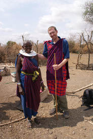
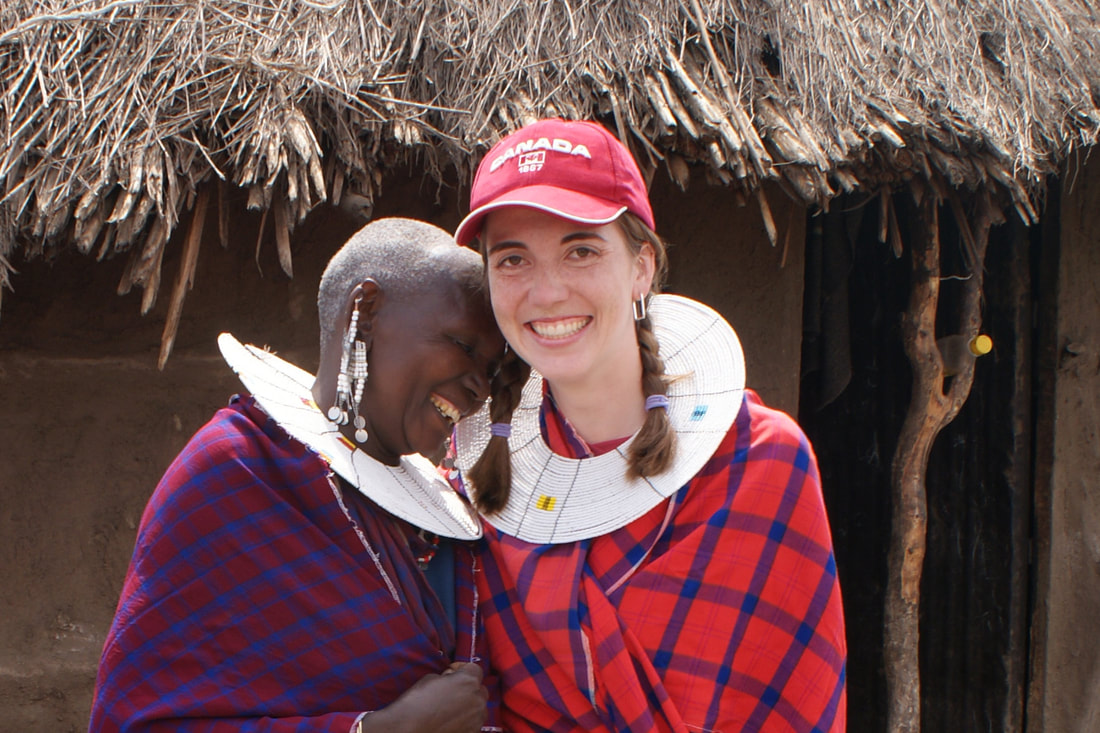
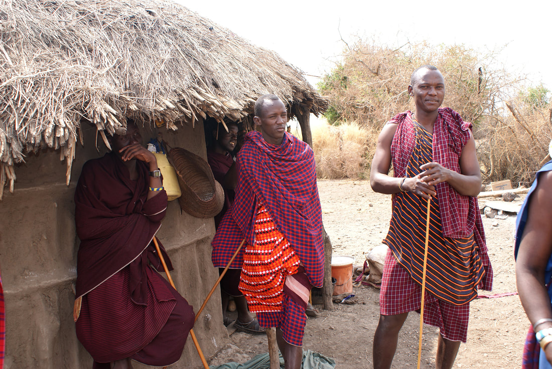
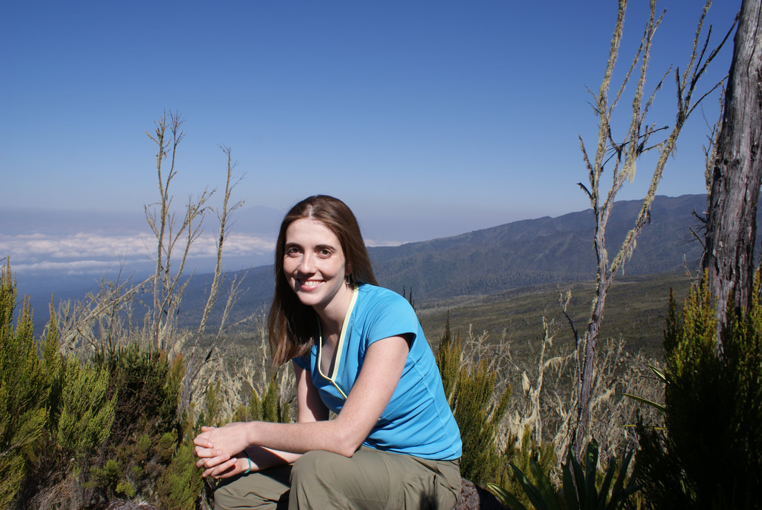
After arriving in Kenya to first visit our sponsor child, we by traveled by bus from Nairobi across the border into Arusha, Tanzania. The drive was bumpy and uncomfortable....and really interesting. It's amazing to look out at your surroundings and see the Maasai people in their native habitat. It was our first glimpse at an incredible semi-nomadic people who largely inhabit southern Kenya and Northern Tanzania. Later in our trip, we were able to spend some time with them in their traditional boma houses. Maasai people are very tall and skinny, so they just adored Niels. They dressed him up and called him their own "white Maasai."
We spent some time in Arusha, and then traveled to the smaller town of Moshi - the starting point for our hike! |
|
|
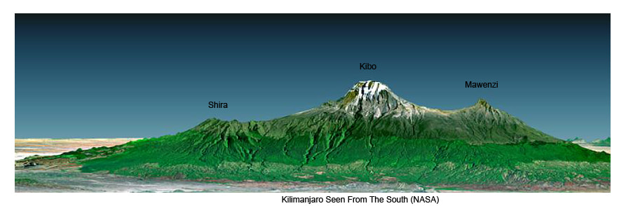
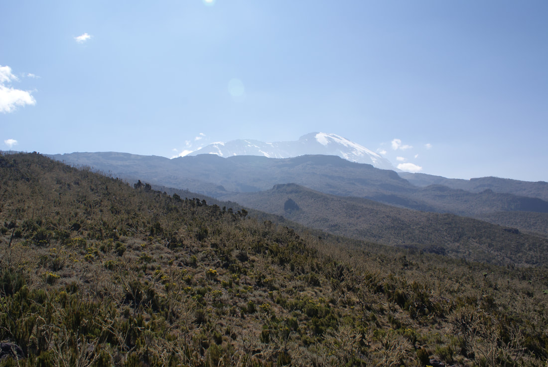
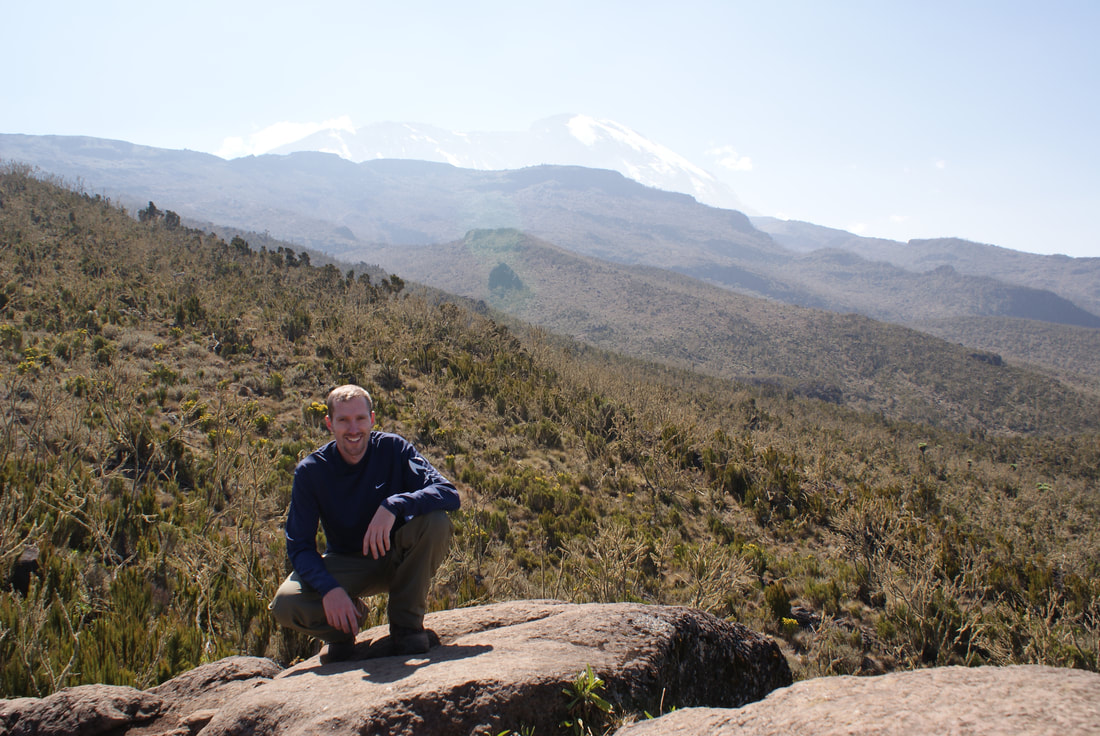
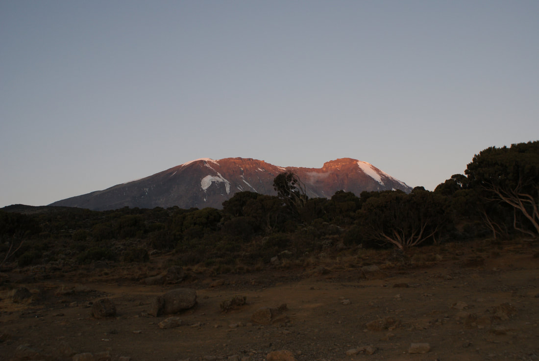
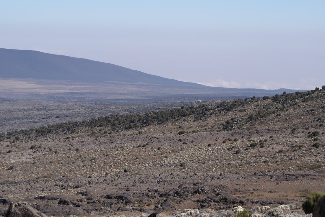
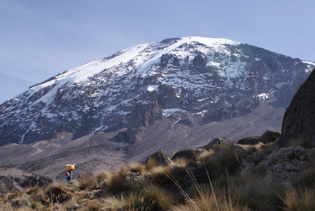
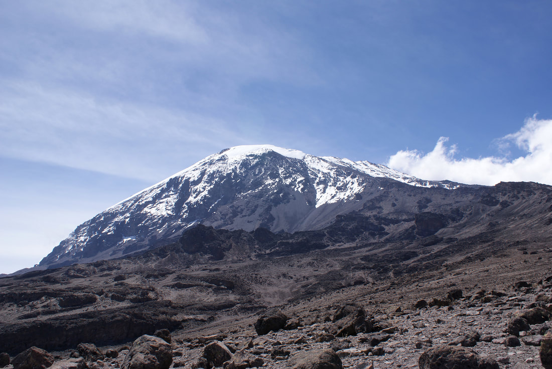
Kilimanjaro is actually a large "stratovolcano" composed of three distinct volcanic cones: Kibo (the highest), Mawenzi and Shira. Both Mawenzi and Shira are extinct, but Kibo is only dormant - which means it could erupt again!
Uhuru Peak is the highest summit on Kibo's crater rim - and our destination at 5,895 meters (19,341 ft).
Uhuru Peak is the highest summit on Kibo's crater rim - and our destination at 5,895 meters (19,341 ft).
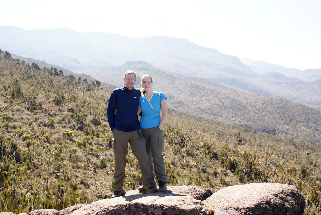
Our Route: Machame (7 day version)
Niels and I decided to take the Machame Route up Kilimanjaro for two main reasons:
1) This route is known for having stunning views as you trek through a series of very different biomes. It also takes a "loop" approach, so you descend via a different route than you ascend. The more common route (Marangu) uses the same way up as it does down, thus repeating the scenery (and really, who wants to do that?).
2) Machame Route has a high success rate, especially when you opt for the 7-day version instead of the 6-day one. This high success rate is due to two main reasons: One, it has a 'climb high, sleep low' opportunity for trekkers on day three, where you ascend to Lava Tower to eat lunch, and then descend to sleep at Barranco camp. Based on my previous Himalayan hiking experiences, this counts for a LOT. Two: the Machame route simply takes longer and has a more gradual incline. In general, the longer you spend on a mountain, the higher chance of success you have at acclimatizing to the altitude and avoiding altitude sickness.
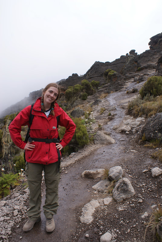
The "down" sides are that the Machame route is relatively difficult (as climbers need to be able to ascend the Barranco Wall on day four and manage the very steep incline up Kibo on summit night) and that it is more expensive (simply because you are trekking for longer).
Weighing the options, we really wanted to experience the scenic views along the Machame Route and actually summiting was important to us. When you fly halfway across the world with a goal in mind, I'd like to do everything possible to achieve it and felt that adding a day or two onto our hike was well worth it.
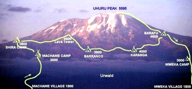
Our route up! The tent symbols are where we slept. The seven day version of the Machame Route let us sleep at Karanga, thus having an extra day to acclimatize... as well as storing up energy for that last haul up to Uhuru Peak. You can also see Lava Tower, our "Climb High" destination for lunch on Day 3... and Barranco, our "Sleep Low" camp for the night.
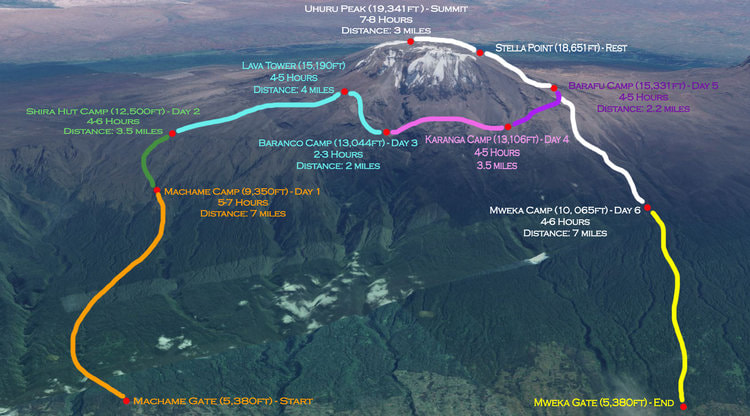
This map of our route gives the distances we walked each day, the approximate times, and the altitudes.
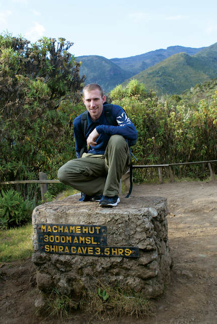
Day 1: Machame Gate to Machame Camp
|
•Elevation (ft): 5,400ft to 9,400ft
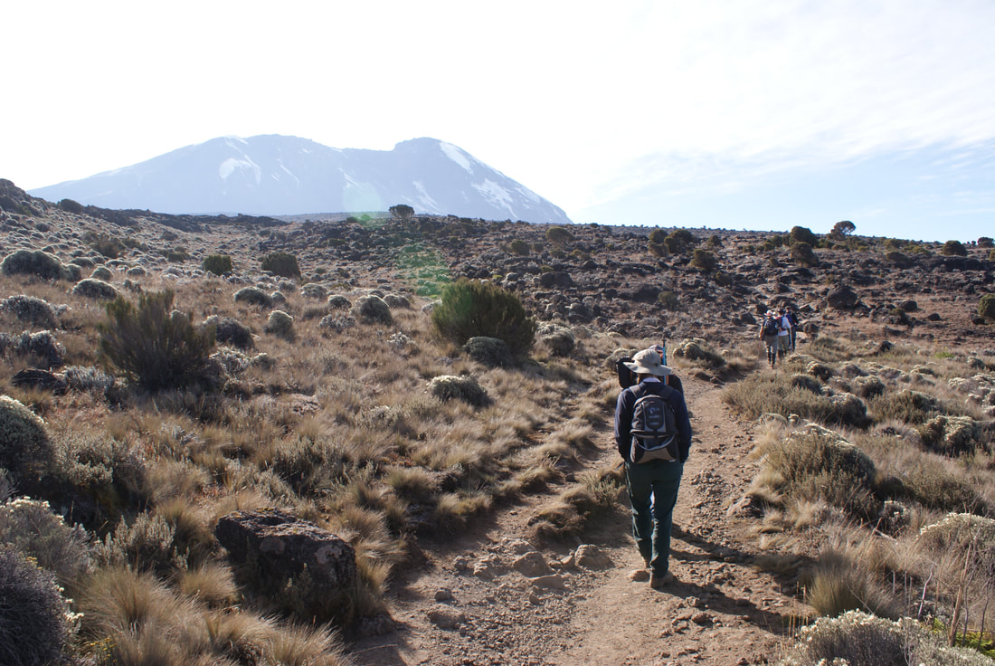
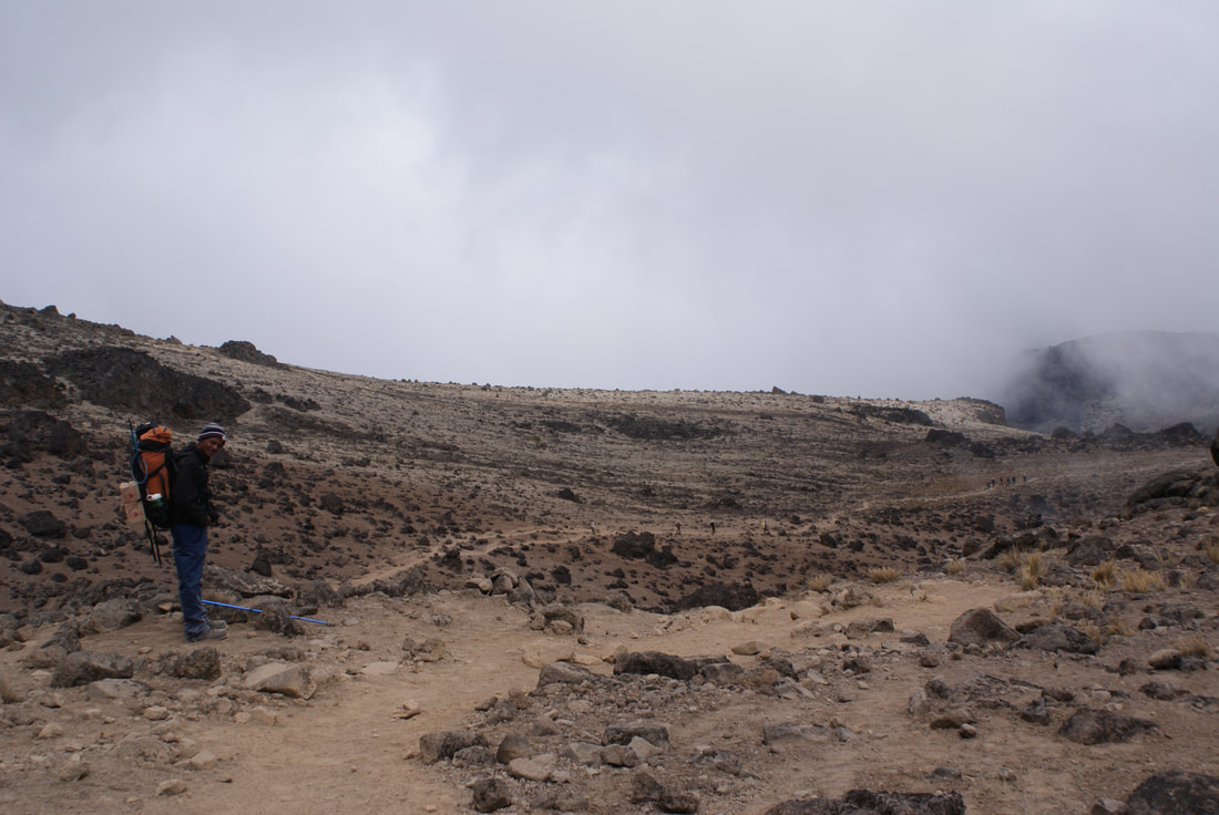
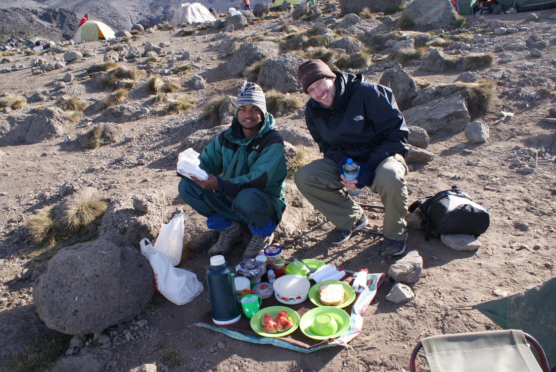
•Distance: 11 km/7 miles •Habitat: Rain Forest Today was the day - August 8th, 2008: the first day of our seven day climb. Niels and I met the owner of our tour company, Paul Robert Shayo, and we all drove from Moshi to the Mount Kilimanjaro National Park Gate, which takes about 50 minutes. The journey passes through the beautiful village of Machame which is located on the lower slopes of the mountain. Paul told us that Machame is known for growing exceptional coffee (yum!) and it also has a hospital for all those ill prepared hikers. I silently said a prayer and hoped that we didn't fit into that category. 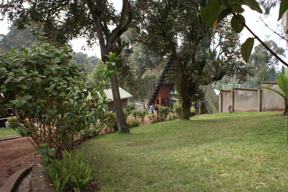
Machame Gate was beautiful!
|
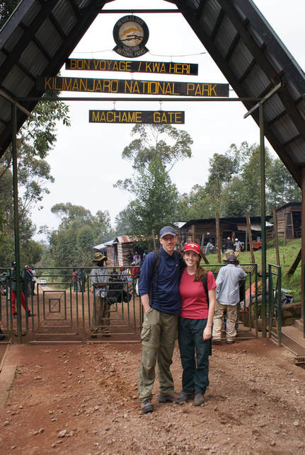
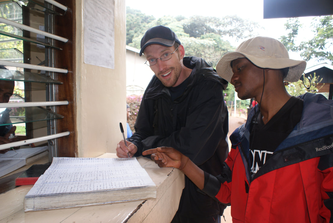
We signed the register and were ready to go!
|
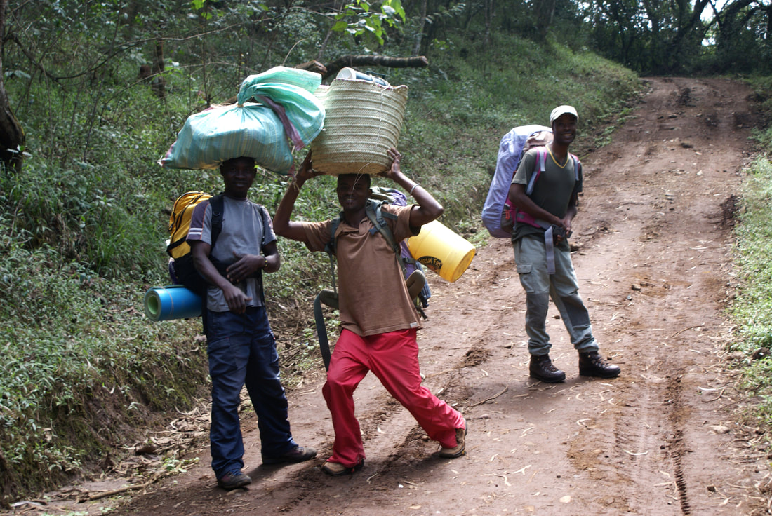
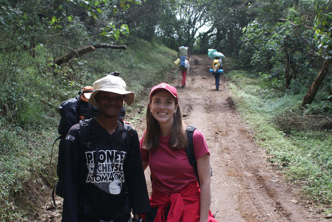
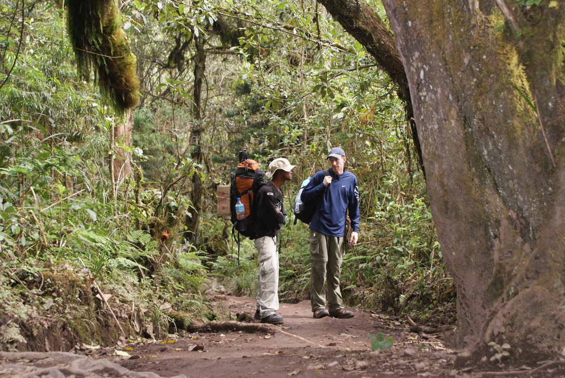
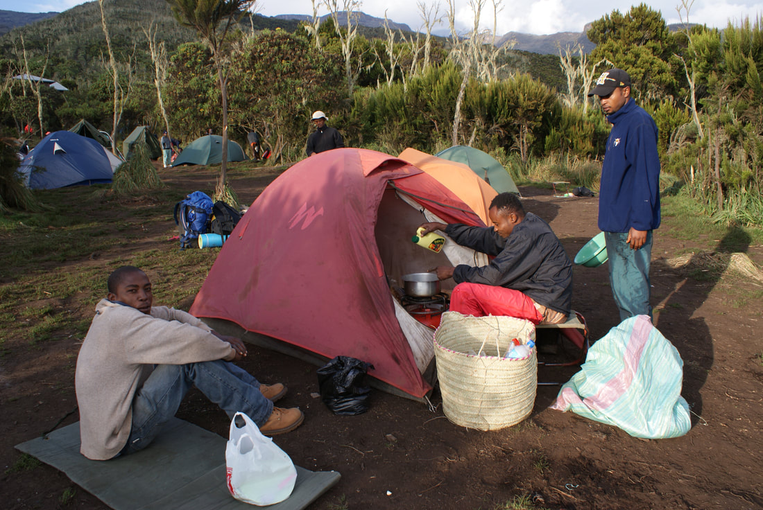
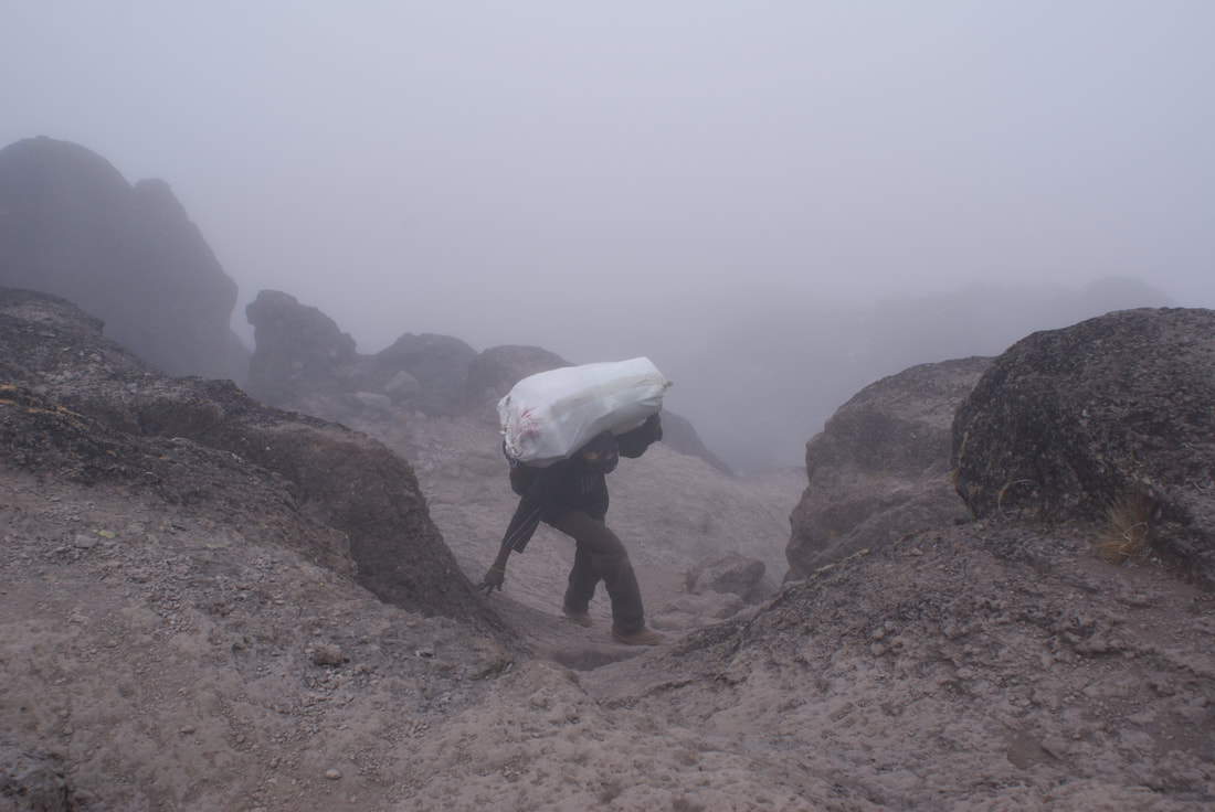
Below are some photos of our team! We tried to hike with as "few" people as possible, but in the end there are strict rules which you have to follow to climb Kilimanjaro. By Tanzanian law, you must have a guide and at least two porters with you on the mountain. There are also camping and food laws, so most trekking companies insist on a cook as well. I've never had a team of SIX accompany me up a mountain (in the Himalayas is was just me and one guide!), but that's what we had to go with. We decided to hire Paul Robert Shayo's company based on excellent reviews, a competitive budget price... and the fact that he would allow us to "only" take up six people. Other companies were quoting us for a team of twelve!!! In the end, I would highly recommend Paul - great service, honest and flexible company, and a very personable team.
If there are two hikers ascending Kili, you need a guide AND an assistant guide. While booking from Canada, I remember giving the tour companies a bit of a hard time about needing two guides for only two people. Did we really need this? Every single company I asked assured me that we certainly did: many travelers end up splitting up if one suffers from altitude sickness and has to descend quickly, or one hiker gets injured and the other wants to still try for a successful summit, etc. I thought this sounded absolutely ridiculous - of course Niels and I would never split up on a mountain.
Ha! Spoiler Alert: we did split up, by sheer necessity, on Day 6... and our dutiful guides followed us separately down the mountain, each one taking care of us as we felt our bodies giving out!!
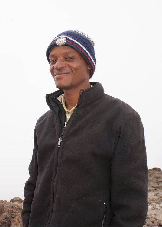
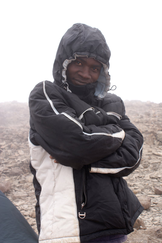
Shawn, our guide
|
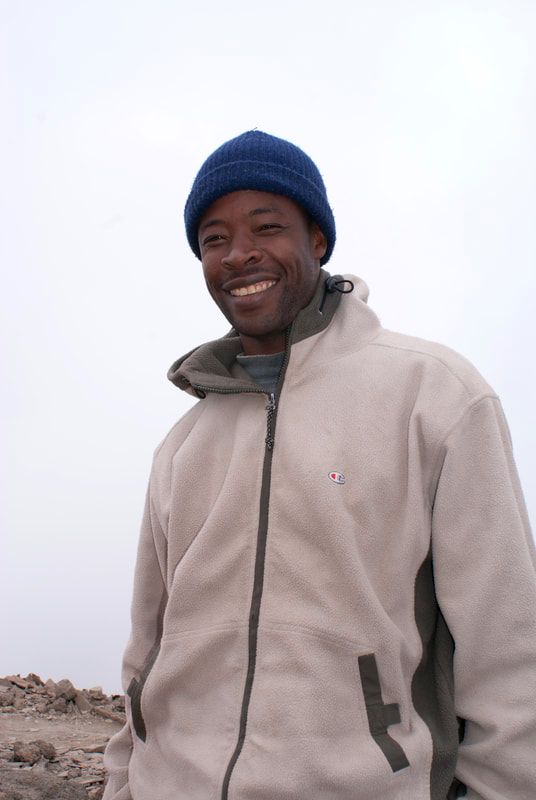
Msuya, assistant guide
|
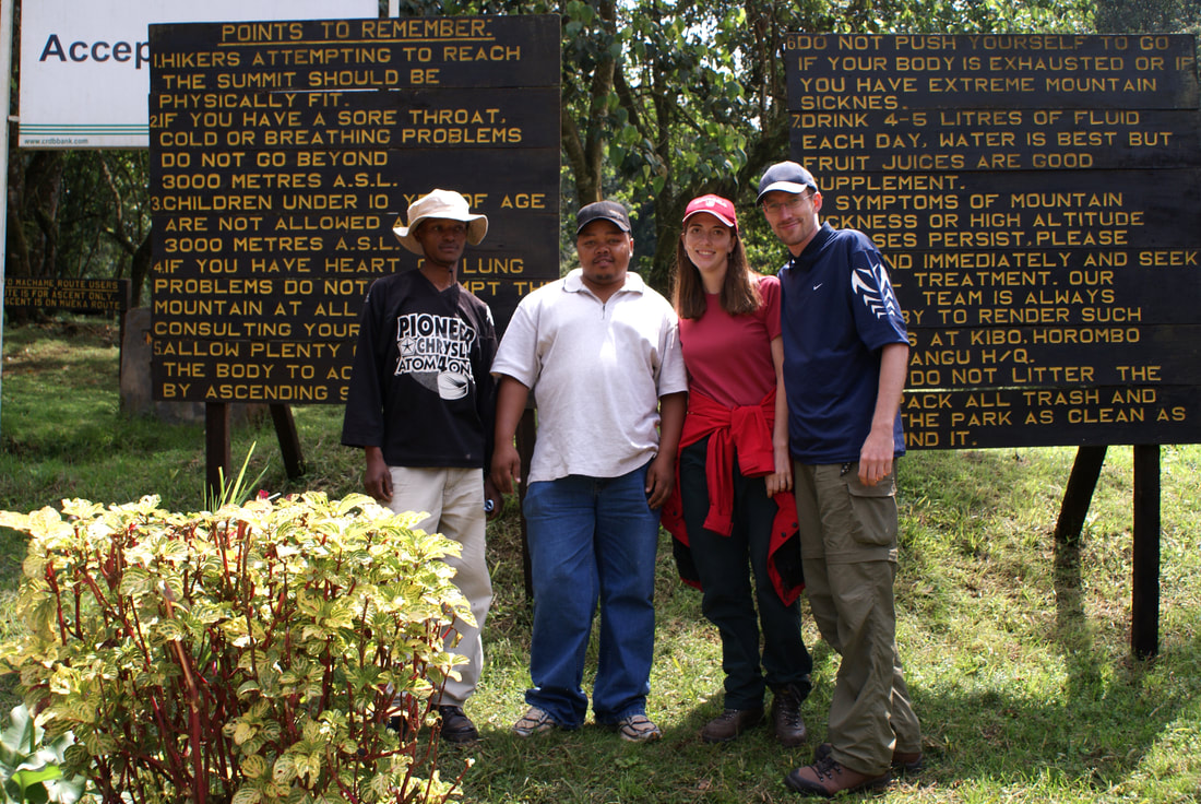
Shawn, Paul (who owns the company), Shannon, Niels
|
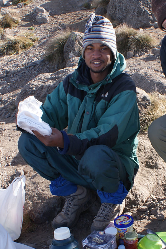
Allie, our cook
|
Abassi, our waiter
|
Gabriel, our porter
|
Filbet, our porter
|
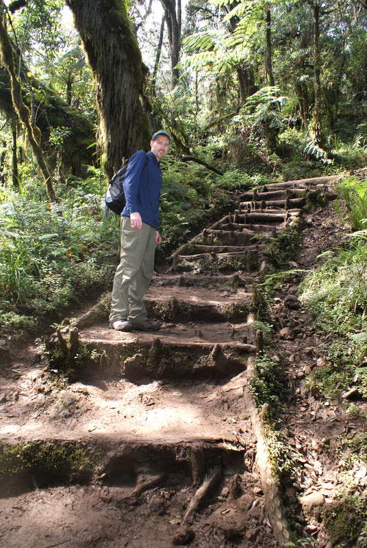
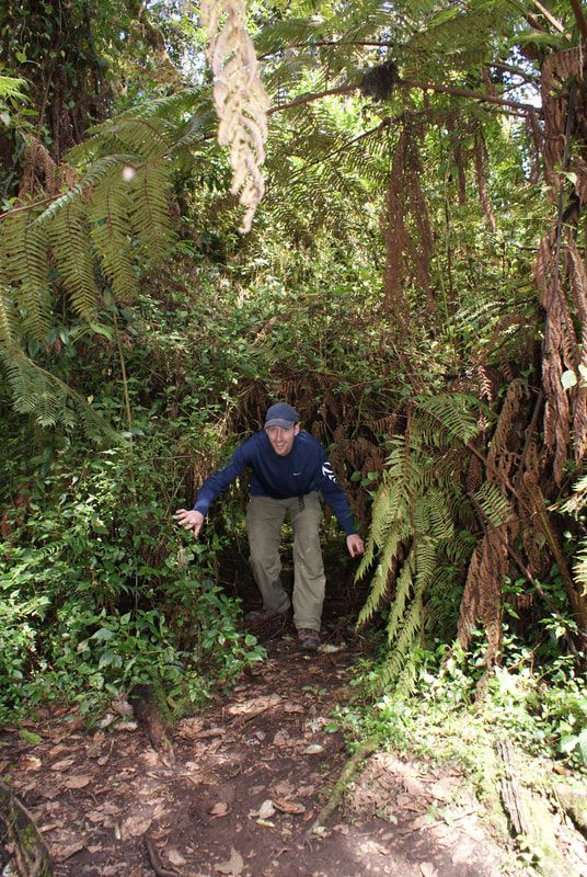
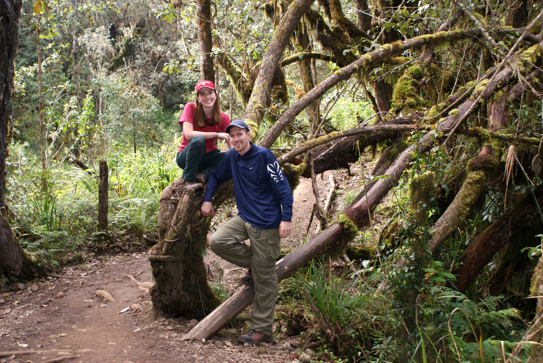
We left Machame gate full of energy for the day's hike ahead: 11 kilometers through lush African rain forest. The first few kilometers followed a four wheel drive track, but that soon became a neat, wide footpath.
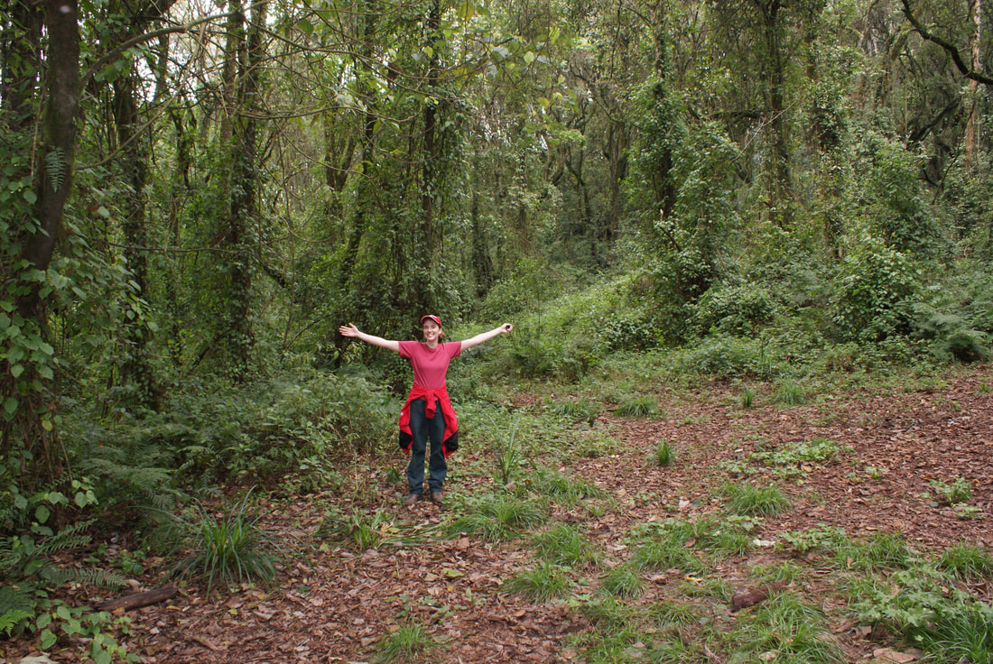
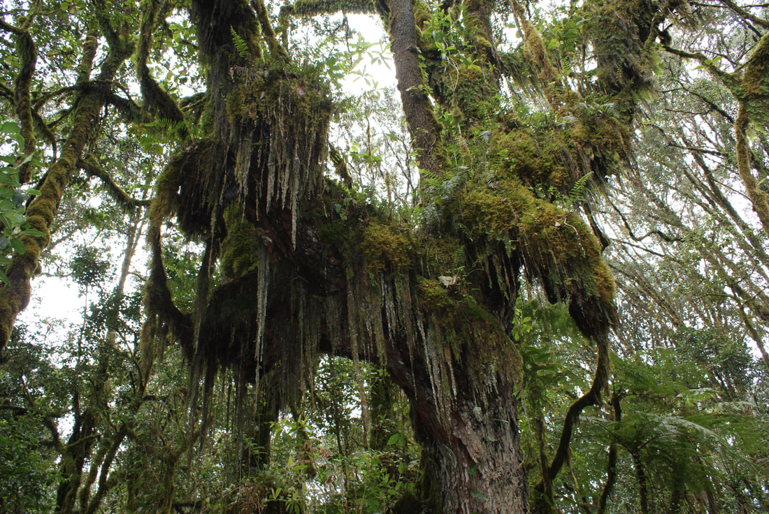
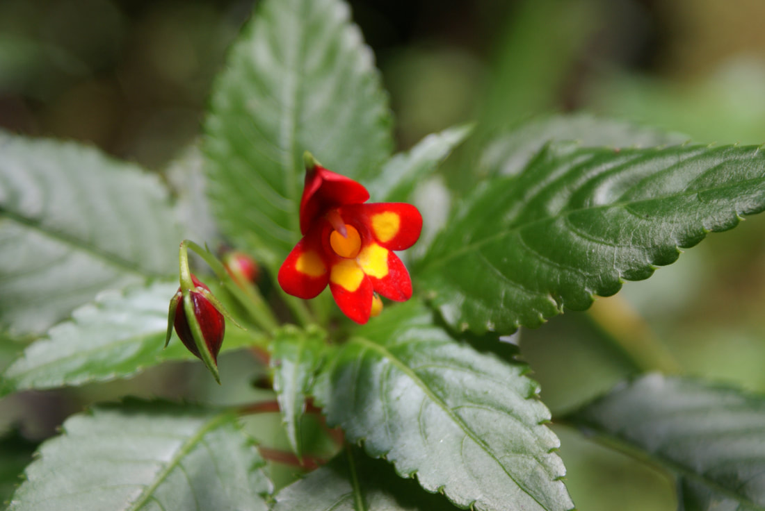
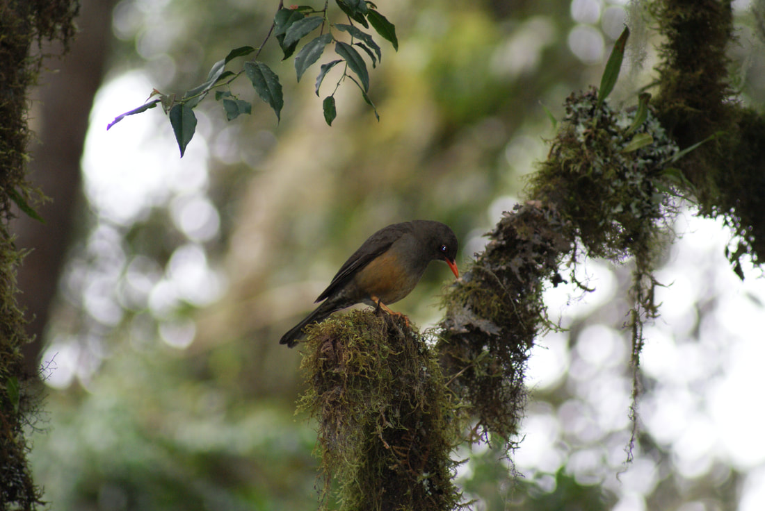
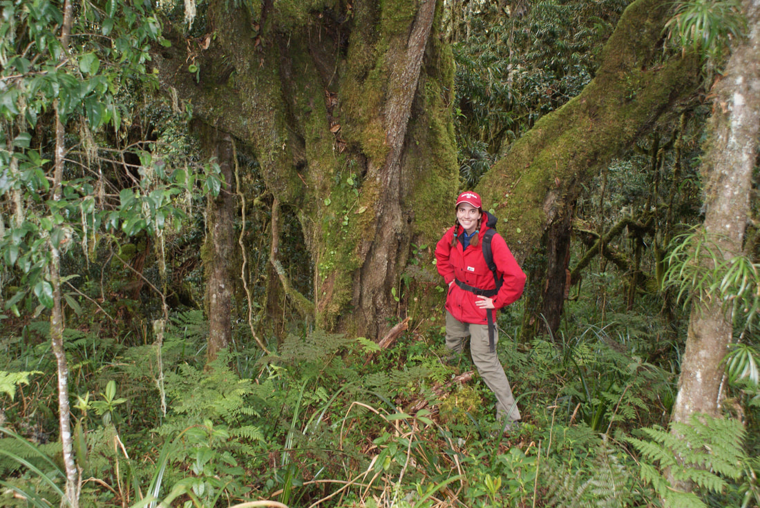
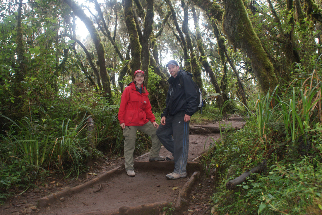
The forest is beautiful. It's lush, deep, green and misty. We commented how it felt like a "Lord of the Rings" forest, especially with the moss and lichen dangling from the tall branches. Tree ferns provided lots of shelter and there were many beautiful flowers and birds.
|
|
To be honest, day one was very exciting. It was a long hike, but very enjoyable. The paths were easy, the company was fantastic and the scenery was beautiful. We just kept marveling at the thought that we were finally here: in Tanzania, climbing such an incredible mountain.
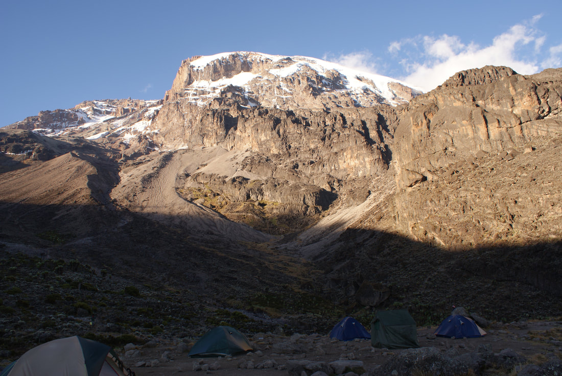
The day’s trekking ended at Machame Camp, which sits near the border of the rain forest zone and the low alpine zone. When we arrived, our porters set up our tents and Allie made us a delicious dinner. The soup he made on the first night was to die for. Please note in the photo below: he's pouring oil on an open gasoline flame inside a tent. Agh!
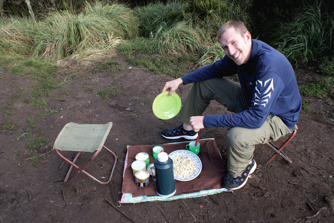
They gave us snacks before dinner.
|
That's Kili right behind our tent!
|
I remember only one thing that night: I was FREEZING. Absolutely, Canadian-cold, freezing. I didn't expect it to be this cold... after all, we were in Africa virtually ON the equator. I thought of all the locals who had assembled outside the Machame Gates that morning trying to sell hats, carvings and more. If only they were allowed up to Camp #1 - I honestly would have paid $50US for a warm pair of gloves!
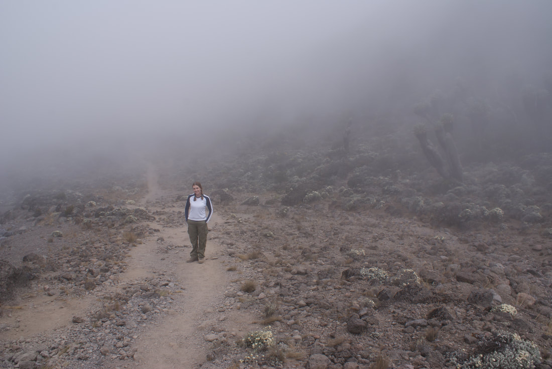
Day 2: Machame Camp to Shira Camp
|
•Elevation (ft): 9,400ft to 12,500ft
•Distance: 5.5 km/3 miles •Habitat: Moorland After a cold night's sleep, we awoke the next morning and prepared for the trek up to Shira Plateau, where we would camp for the night. A delicious breakfast gave us fuel, and a little bowl of water gave us... a shower? Ha! Nope, that little bowl of water gave us a futile attempt at cleanliness. 
What a gorgeous view to wake up to!
|
This handsome boy is ready to hike!
|
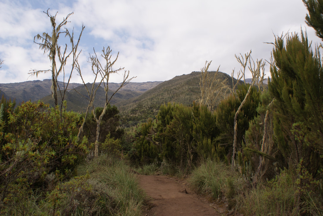
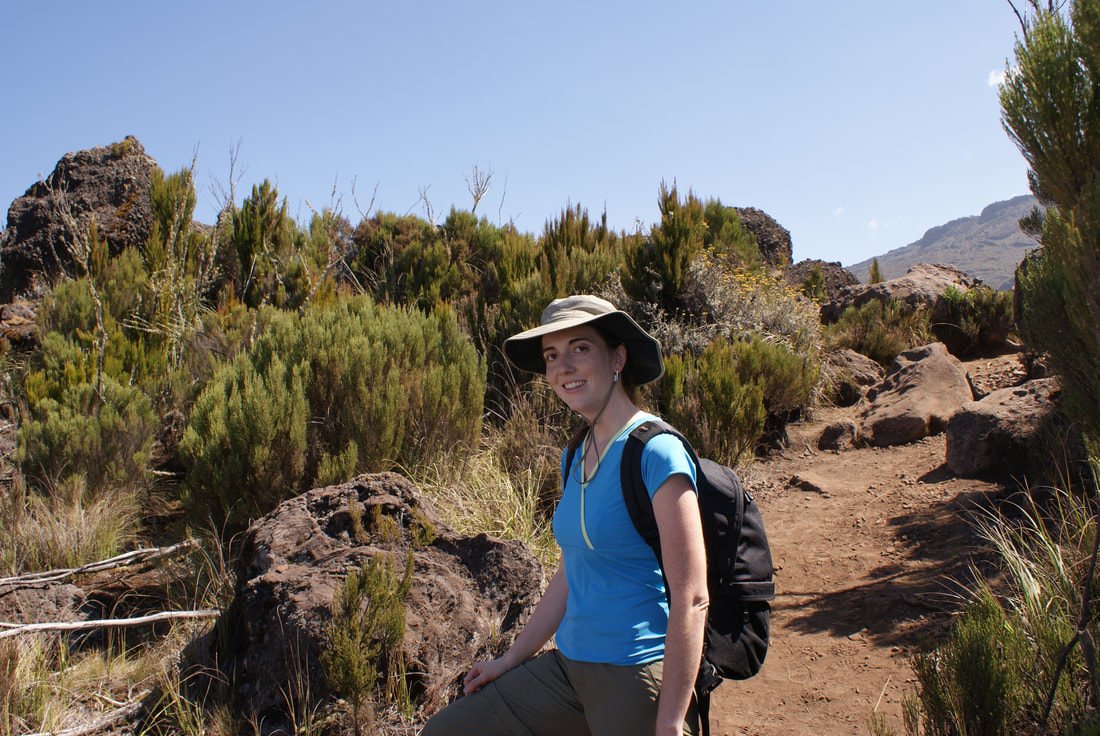
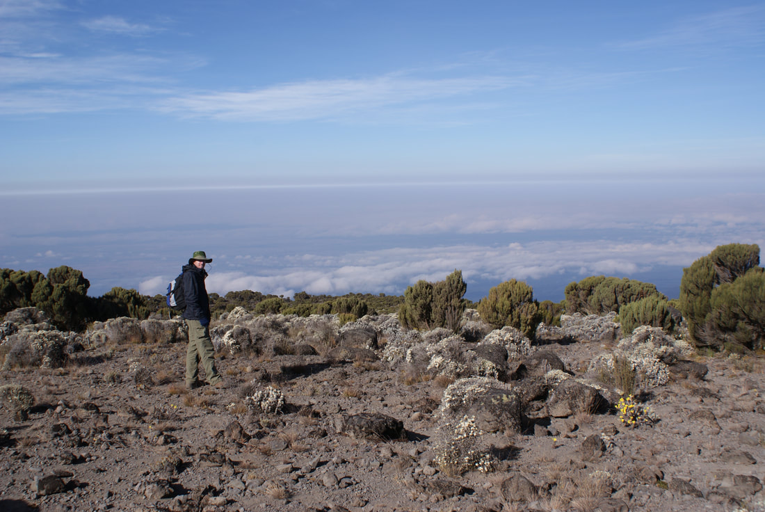
Our trek today was relatively steep as we entered the low alpine zone, which is characterized by moorlands and grasslands. We began to climb for an hour or so, reaching the top of the forest line and then walking along a high rocky ridge - with amazing views of the clouds below us... and Kilimanjaro in the distance. It seemed oh so far away... would we really be standing on that summit in a few days?
We're above the clouds! Incredible!
Niels and I, excited to be above the clouds
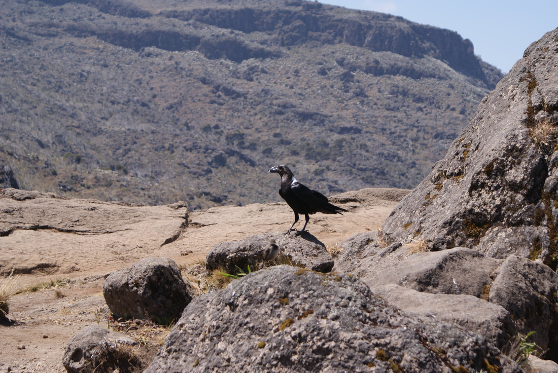
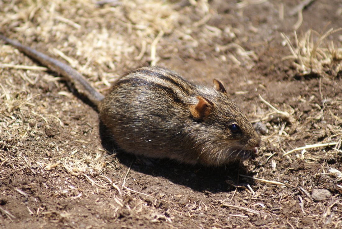
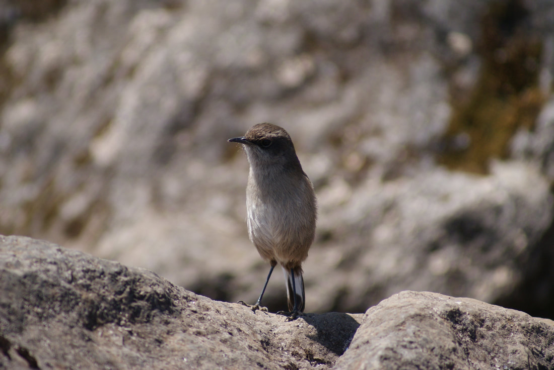
Due to the changing vegetation, we were now exposed to the hot sun (which I found truly lovely), so we had to don our sunscreen as we ate our bagged lunch. The minute we pulled out food, we were surrounded by little mountain rodents and birds begging for their portion of our stash. It was incredible to just sit and enjoy the vegetation and wildlife... and oh yes, the picture perfect view of Kilimanjaro beside us. When Niels announced that he didn't like hard-boiled eggs and would trade his for my sandwich, I further relished in the fact that I had indeed chosen a perfect mate.
|
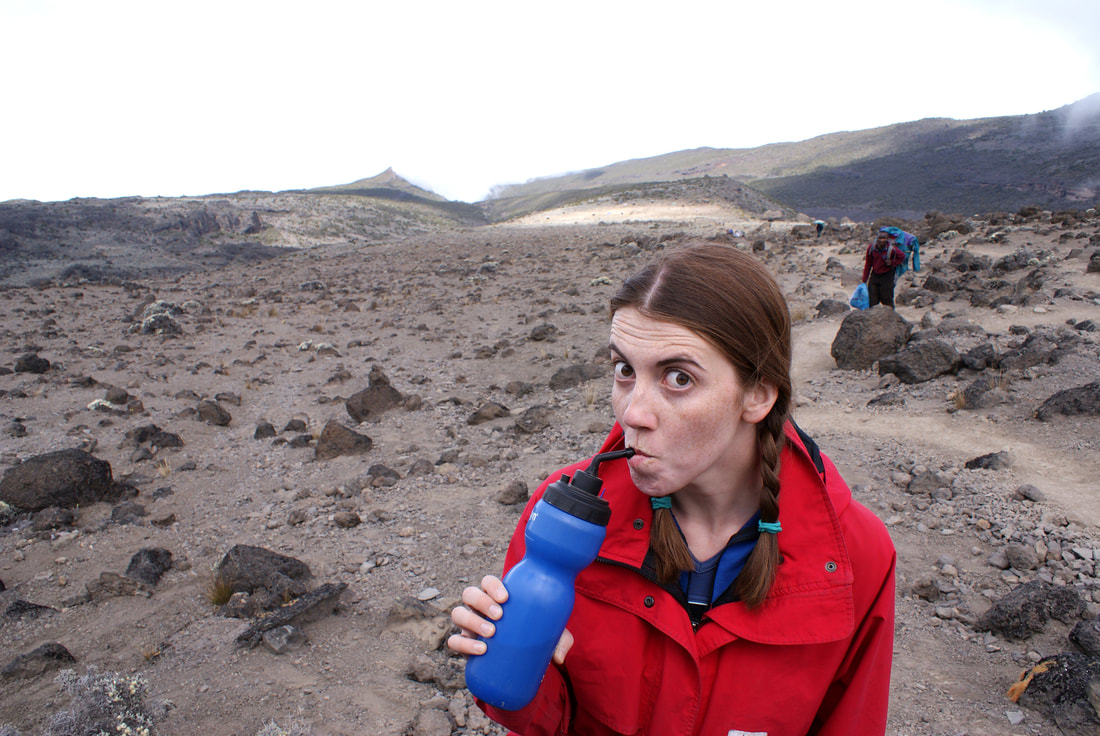
Unlike day one, which had featured a fairly level and tree covered path, day 2 was determined to let us know that we were indeed climbing a mountain. On paper it looks easy (only 5.5km?) but in reality, it was pretty steep and taxing. To the right is a photo of our path... we kept hiking over one little peak only to discover another one, and another, and another. The hot African sun beat down on us, and we needed to take water breaks regularly. After being given bottled water only on the first day, from this point on we now relied on boiled water from the little mountain streams we crossed.
|
|
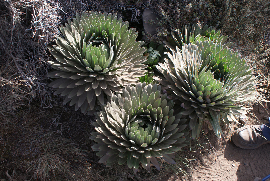
We were now surrounded in alpine vegetation, including trees covered in long, yellow lichen. Strange pineapple-shaped trees, caves and rock pools all added to the feeling that we had left Lord of the Rings and were now on the set of Jurassic Park.
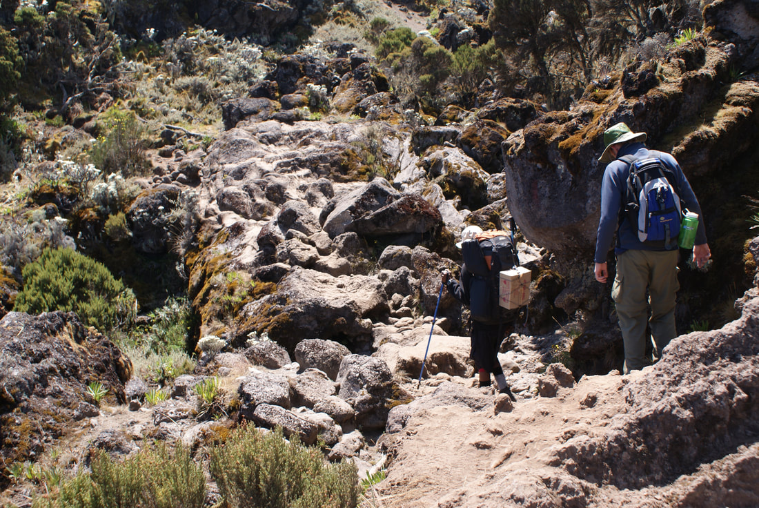
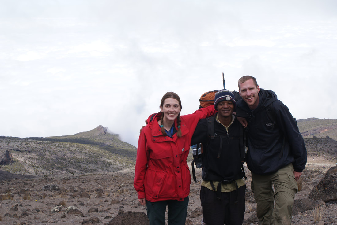
While we hiked, our guides stayed with us but our porters and cooks went ahead. Their bodies are so used to the altitude, and they can easily make camp hours earlier than us. It was nice to walk with our guides, and we spent quite a bit of time learning some common Swahili phrases from them. Niels turned out to be a pro at this, and was using them all the time throughout our trip.
After scrambling up for quite a ways, we finally reached Shira Plateau. What an astounding view of Kilimanjaro to the north west.
After scrambling up for quite a ways, we finally reached Shira Plateau. What an astounding view of Kilimanjaro to the north west.
|
|
Shira Camp was my favourite spot to tent on the whole hike. Don't you feel like the photo below is right out of a travel magazine? It's hard to believe that our tent is in that photo... and that we were well on our way to summiting the highest peak in Africa!
Goodnight Kili. Sleep well. I will see you in the morning.
Day 3: Shira Camp to Lava Tower to Barranco Camp
•Elevation (ft): 12,500ft to 13,000ft
•Distance: 11 km/7 miles
•Habitat: Semi Desert
•Distance: 11 km/7 miles
•Habitat: Semi Desert
We awoke this morning with an important day ahead of us: our acclimatization hike to Lava Tower, and then the descent into the Barranco Valley. The strategy was to "climb high and sleep low" in order to trick the human body to generate plenty of red blood cells and help acclimatize to the altitude. Although you begin and end the day at virtually the same elevation, the time spent at higher altitude is very beneficial for acclimatization.
We began the day by hiking east up a ridge and then heading southeast towards Lava Tower.
We began the day by hiking east up a ridge and then heading southeast towards Lava Tower.
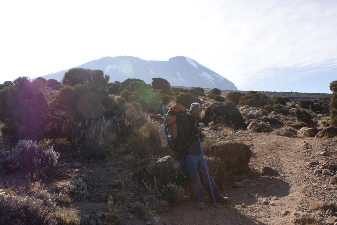
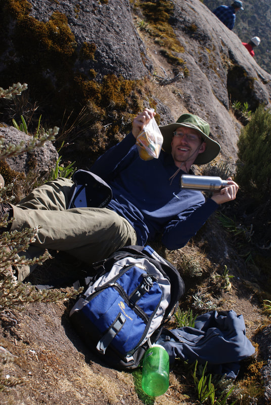
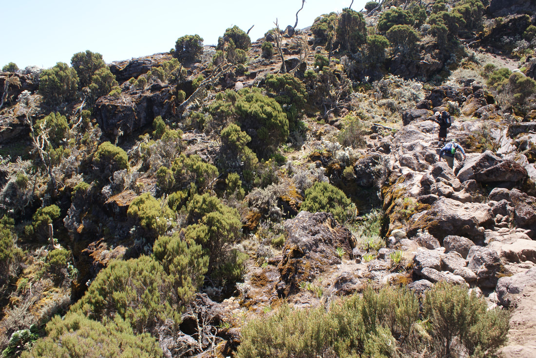
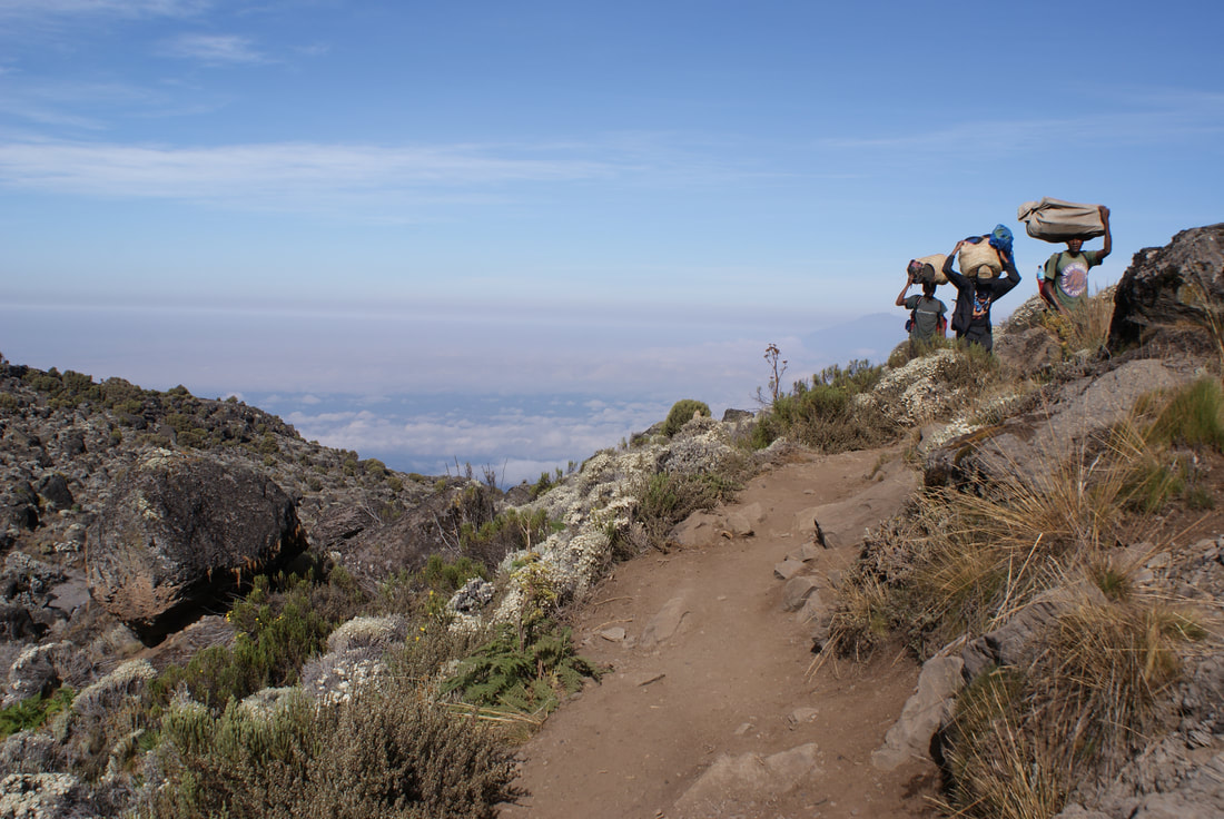
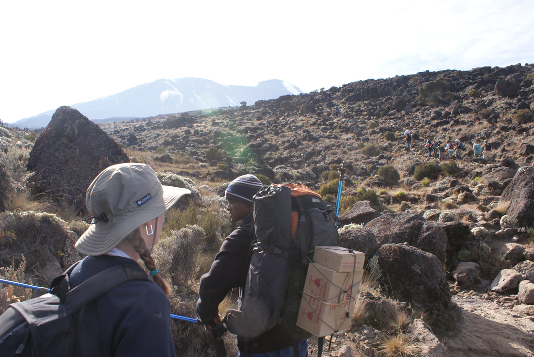
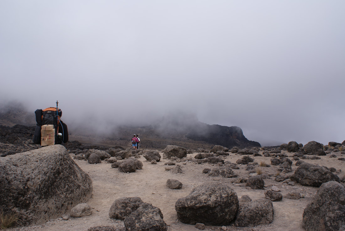
Hiking the seven kilometers to Lava Tower was interesting... at times it felt like we were walking through a field and at other times it felt like we were in a desert. The vegetation was changing almost by the hour. We were also frequently passed by porters, who went ahead of the other hikers on the trail.
Since Kili is so accessible, it sees a lot of foot traffic. We were grateful we decided on the "less popular" Machame Route. There were still quite a few people on our trek... I wondered how busy the Marangu route must be!
We took a moment to appreciate where we were... getting closer to Kili mile by mile.
|
|
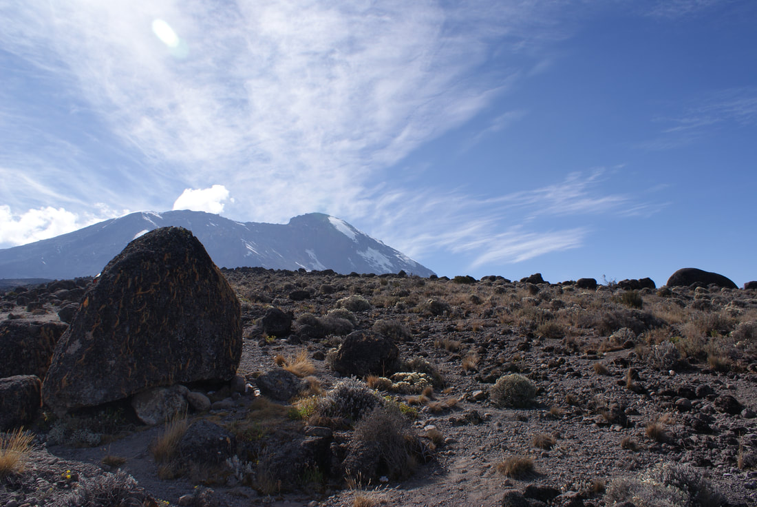
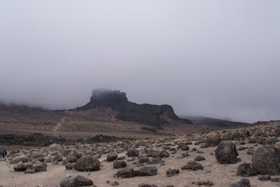
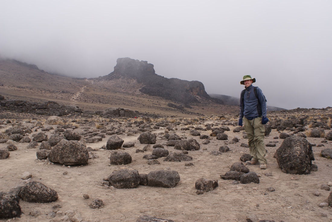
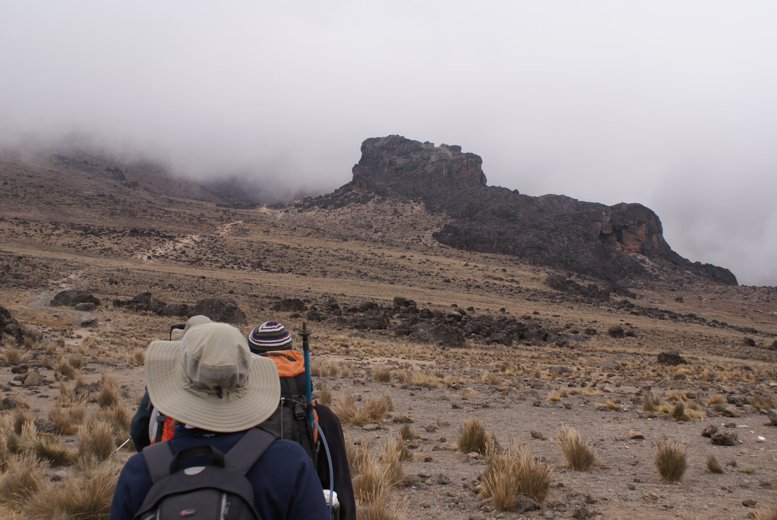
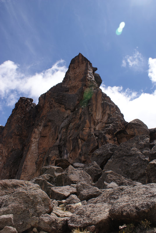
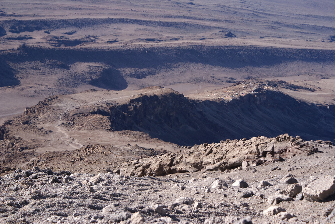
Along the way to Lava Tower, we saw all kinds of strange rock formations. This, plus the lack of green vegetation, was a constant reminder that we were hiking up a volcano - not a regular mountain.
|
As we continued on our hike and the mountain mist cleared, we saw our lunch destination: Lava Tower.
Lava Tower is a 300 foot tall rock formation that, yes, was formed from lava. This occurred back in the days when Kilimanjaro was still an active volcano (it's dormant now, although fumaroles near the summit crater still emit gases and it could technically still erupt). Lava Tower is actually a "volcanic plug," which means that at some point in the distant past, lava shot out of a vent at the base of where Lava Tower now stands. The lava then cooled and hardened, thus stopping up the vent below. On active volcanoes, plugs like these can increase pressure below the surface and lead to more explosive eruptions. Luckily, Kili has stayed quiet for over 200 years with this geological “cork” stuck in its side. |
Lava Tower in the distance
|
Our surroundings just felt unreal... all the desert landscape and mist made it seem like we were in another world! When we arrived at Lava Tower, it rose above us like a monument and made quite an impression. Many people were feeling the altitude at this point, but Niels and I were doing well.
|
|
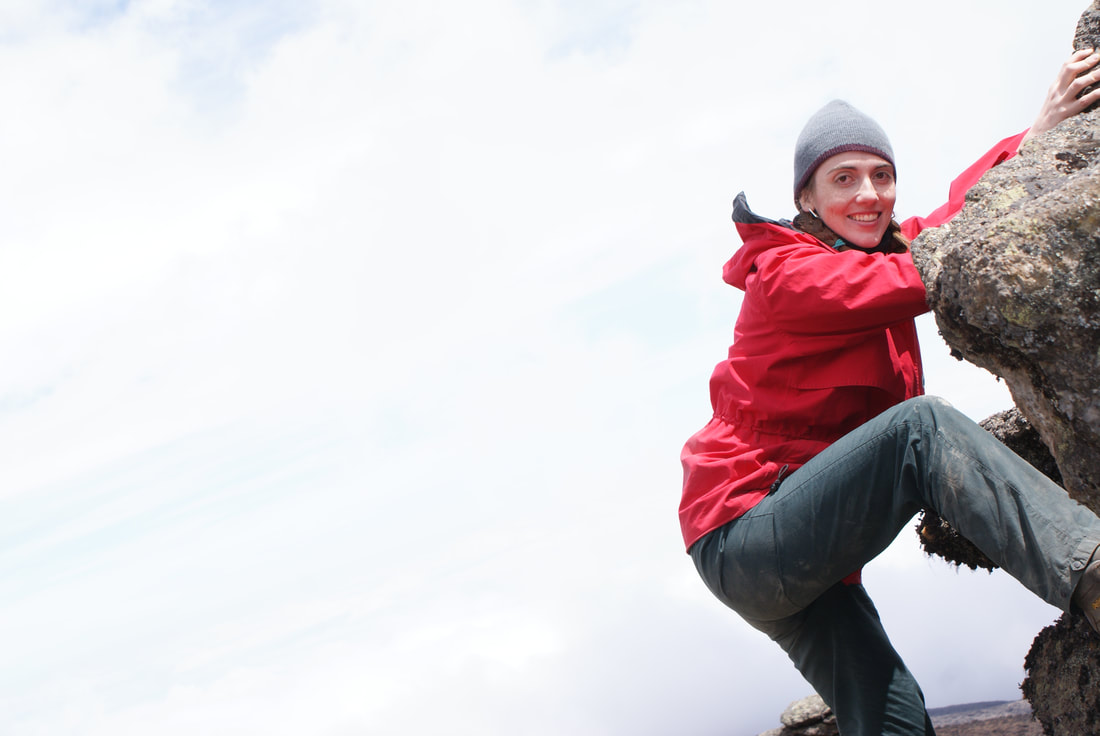
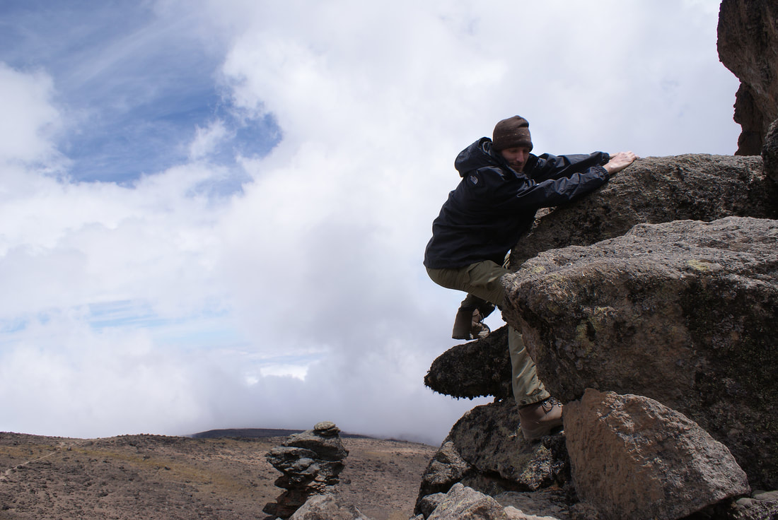
Due to safety concerns, officials have now banned trekkers from climbing Lava Tower (as of 2013). Luckily for us, we made it to Lava Tower before this, so we could play around on the rocks and take some fun pics! Don't worry, we didn't go too high - we just made our photos look that way! We also tried to spend as much time there as possible to acclimatize.... so really, we had to monkey around for a bit.
|
|
|

|
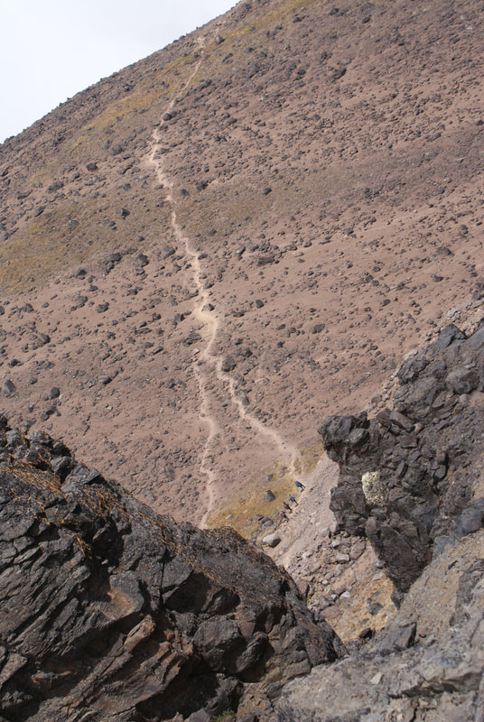
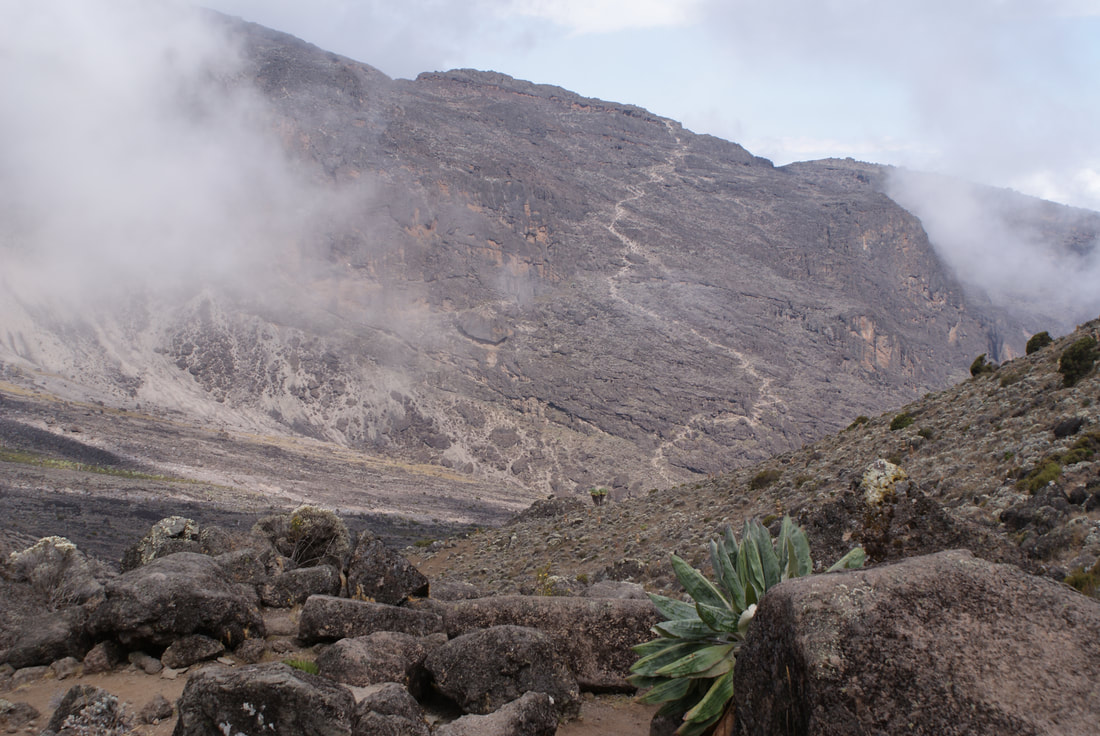
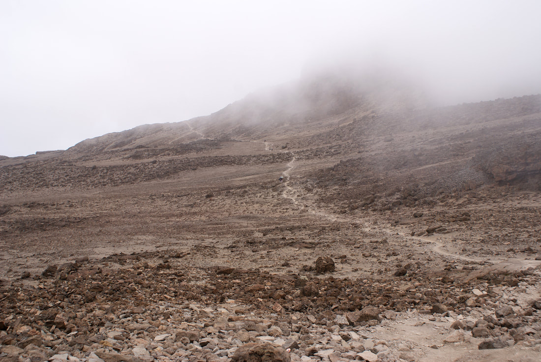
We took time to explore, rest and eat a well-deserved lunch. As we left Lava Tower, we could see the path leading onward, like a thin line snaking through the desert. The terrain on Kili is not technically hard, but it just involves lots and lots of walking... at altitude. This made it seem much harder than it actually was. Many hikers did not continue past Lava Tower, but rather decided to hike back down. The altitude can start to wreak havoc on your system much earlier than the actual summit day. |
Looking ahead to our next section of the trek
|
We continued to trek through more moon-like terrain... on and on and on. At times it was just crazy... where WERE we?
|
After a long while, we arrived at Arrow Glacier, which towered above us. |
|
Wow! Our first up close glimpse at an equatorial glacier. |
|
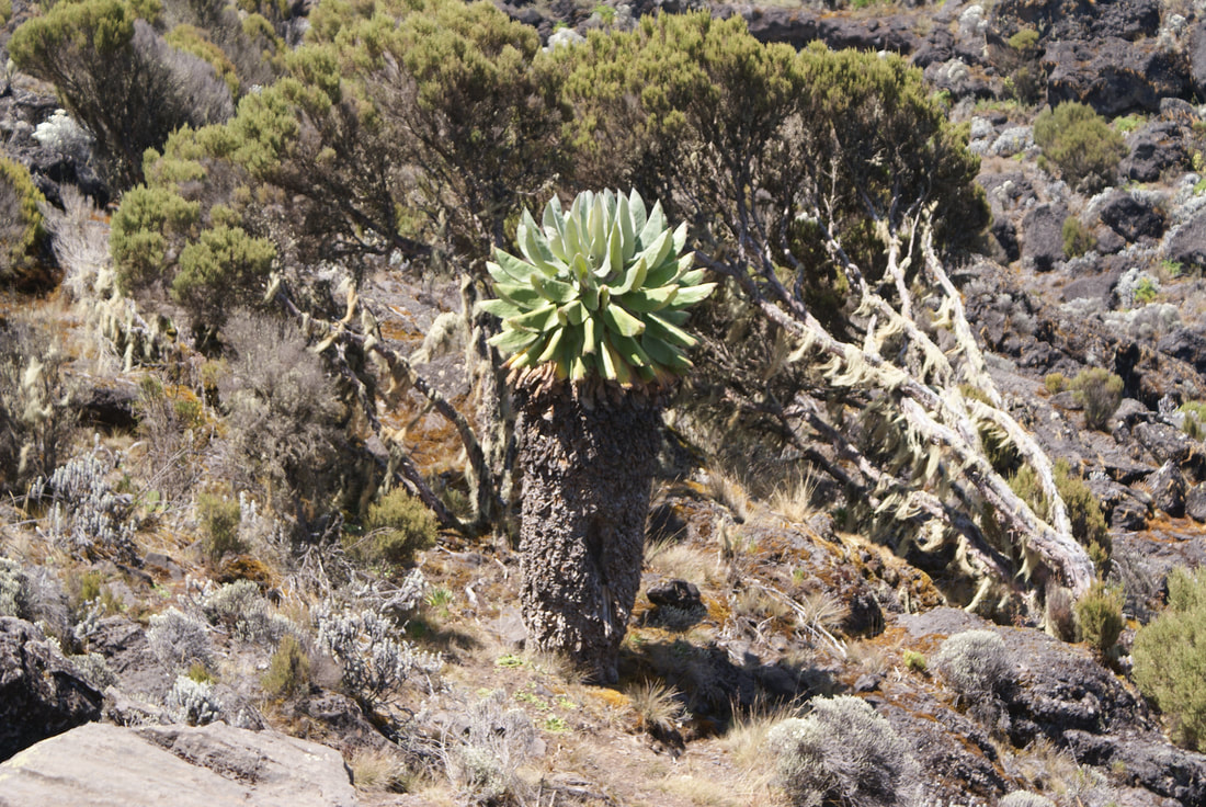
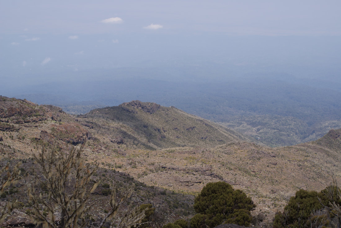
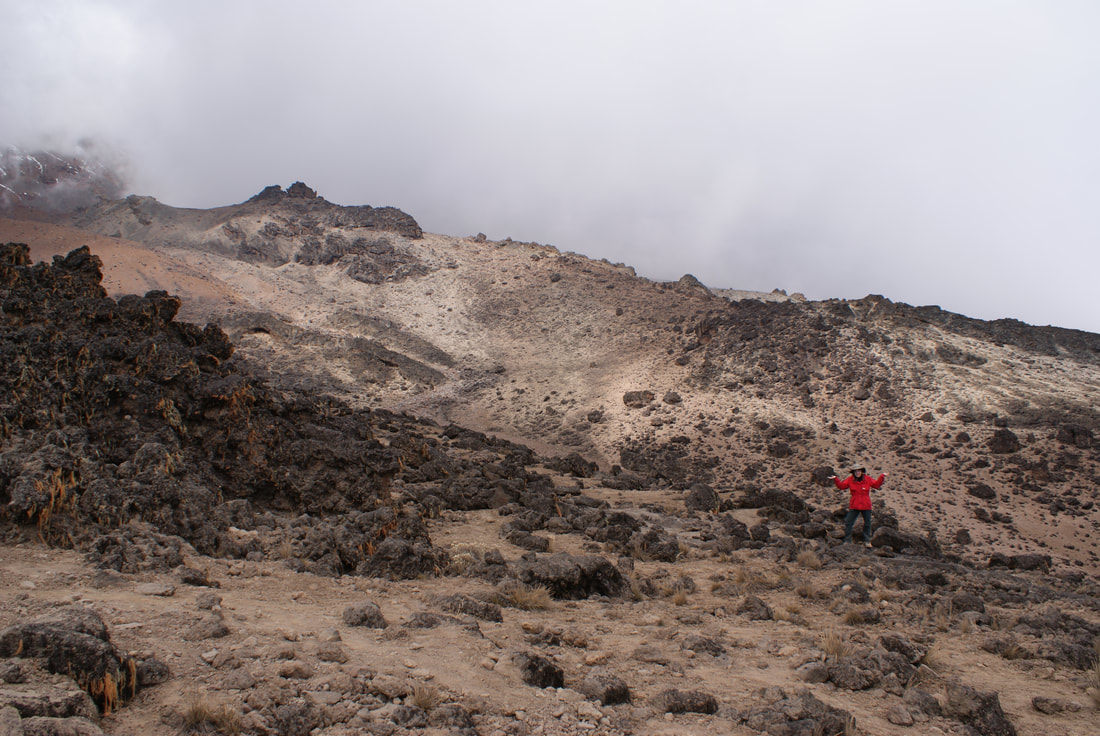
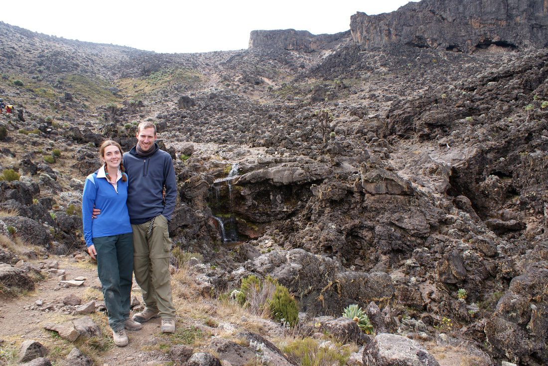
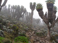
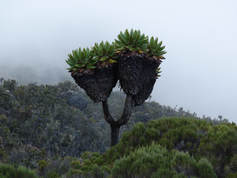
We then started to descend down into the Great Barranco Valley, which was a surreal sight to behold. It is home to the strange but beautiful Senecio Forest, home of the giant Groundsel Trees. I know I keep making book analogies... but it honestly felt like we were in a Dr. Seuss book now! It felt out of this world! These trees are native to the higher altitude zones of equatorial East Africa, so they are very unique to see. The biologist in me did a little happy dance.
|
|
We were exhausted as we arrived at Barranco Camp that day... and the mist was incredible. We couldn't see anything beyond a few feet! This really gave us permission to eat a quick dinner and climb into our tent to sleep. We were oh so tired. Our incredible team had also started to boil water to put in our stainless steel water bottles for the night, which then acted like hot water bottles. What a difference that made! Future Kilimanjaro Hikers beware: at altitude, it gets colder than you think at night!
Don't wander too far from your tent - you might never find it again!
|
Niels posing for the camera... but really, we couldn't see a thing!
|
Day 4: Barranco Camp to Karanga Camp
•Barranco Camp to Karanga Camp
•Elevation (ft): 13,000ft to 13,100ft
•Distance: 5.5 km/3.5 miles
•Habitat: Alpine Desert
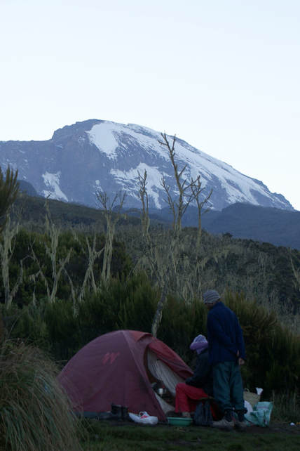
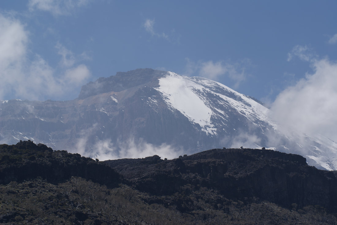
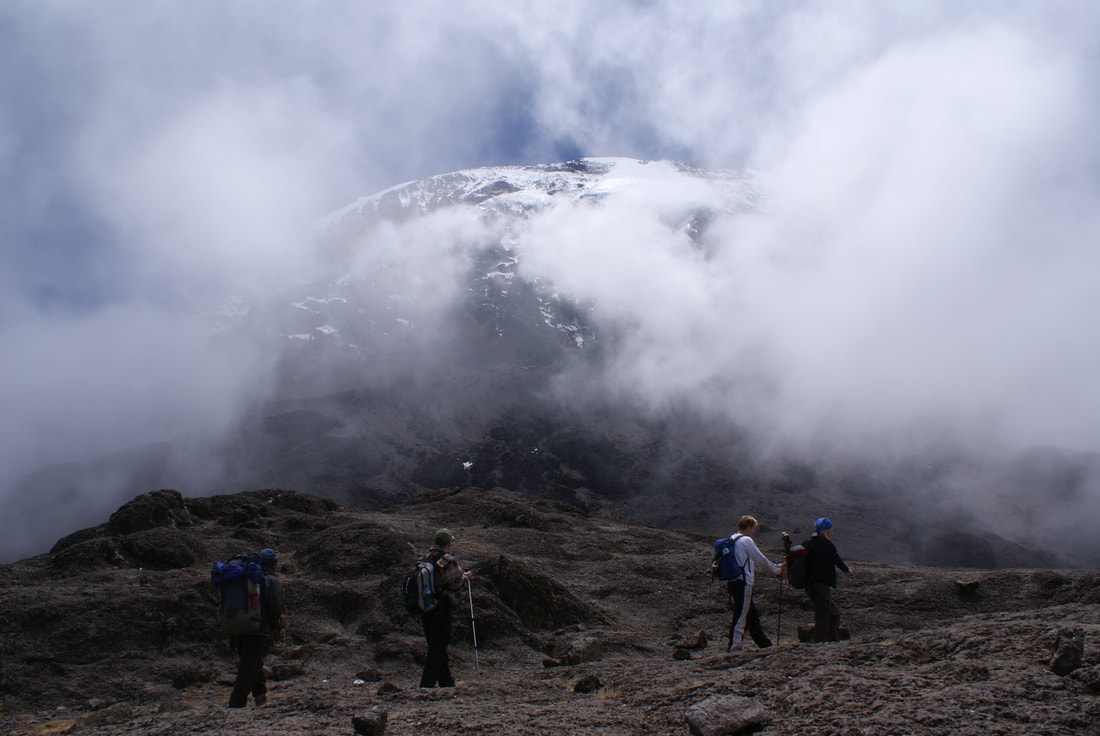
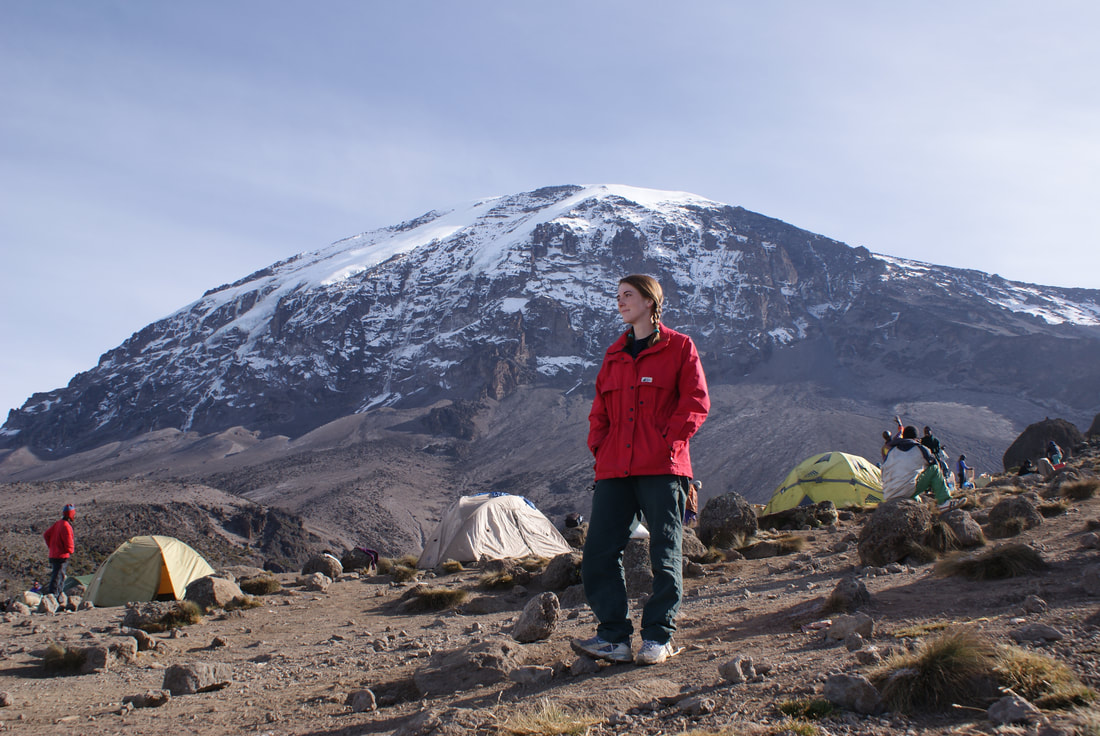
The next morning, Niels and I unzipped our tent to bright sun and our first "mist-less" views of camp. It felt like we woke up in a different world. Unbeknownst to us, we had been sleeping RIGHT UNDER KILIMANJARO! Wow!
That right there is Uhuru Peak, folks - our ultimate goal.
•Elevation (ft): 13,000ft to 13,100ft
•Distance: 5.5 km/3.5 miles
•Habitat: Alpine Desert
The next morning, Niels and I unzipped our tent to bright sun and our first "mist-less" views of camp. It felt like we woke up in a different world. Unbeknownst to us, we had been sleeping RIGHT UNDER KILIMANJARO! Wow!
That right there is Uhuru Peak, folks - our ultimate goal.
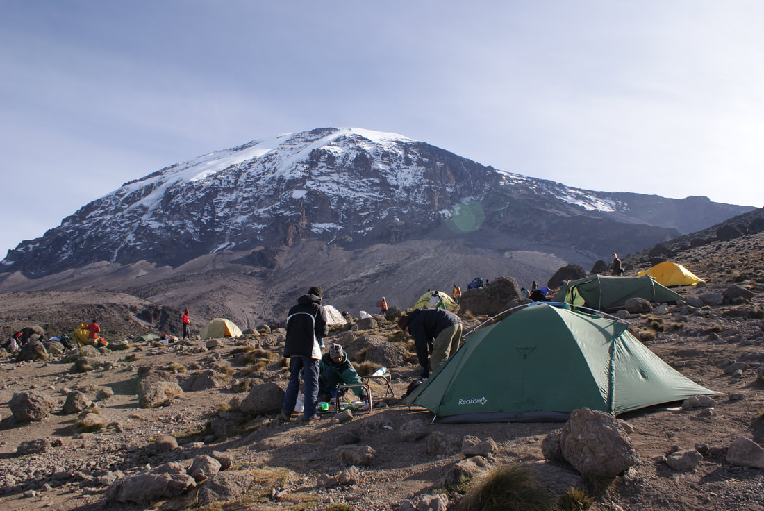
Kili in first light - notice our tents right below it!
|
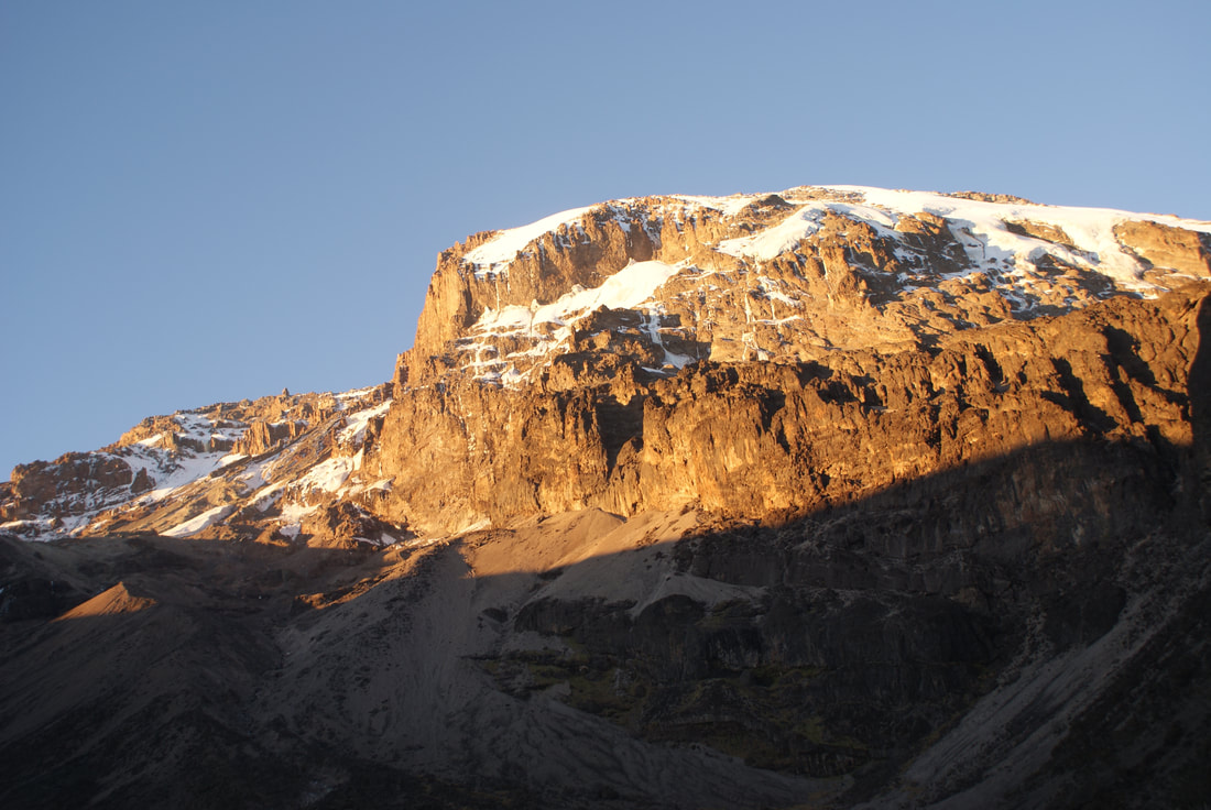
Kili as the morning progressed, and the sun got stronger
|
|
It was incredible to eat breakfast at this majestic spot - one side clouds and the other side Kili. We were half way through breakfast when Niels pointed behind me and said "We have to climb that next." I looked over my shoulder at the ominous steep wall towering above us and laughed. I thought he was joking. He was not. |
|
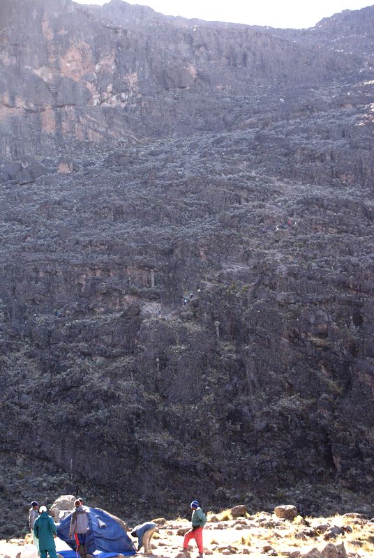
The Great Barranco Wall
|
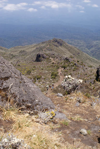
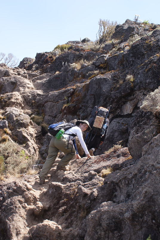
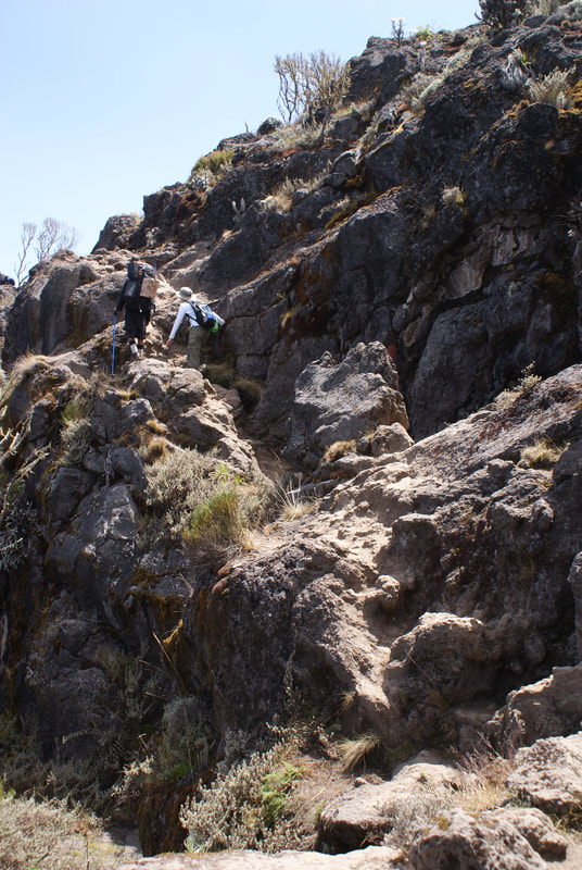
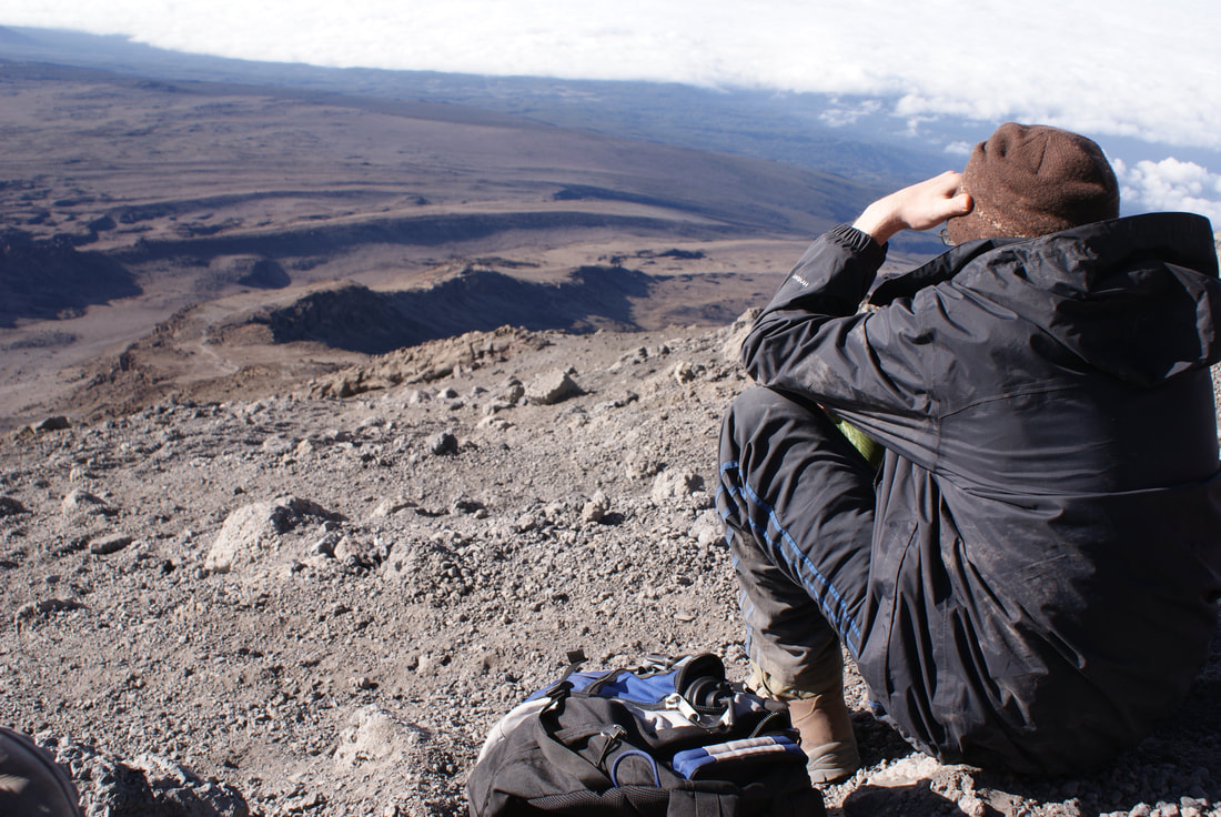
As I squinted my eyes, I could see little dots of people slowing making their way up the incredible steep mountainside, one by one. My heart plunged - this was the 'downside' to choosing the Machame Route that I had somehow forgotten about: the Great Barranco Wall. I sat there in disbelief, my lovely breakfast ruined. How were we going to climb that thing? Putting on my boots at this altitude was a daunting task. That wall? Impossible. Look at the photo to the left: can you see the little dots of people zig-zagging their way up the Great Barranco Wall? |
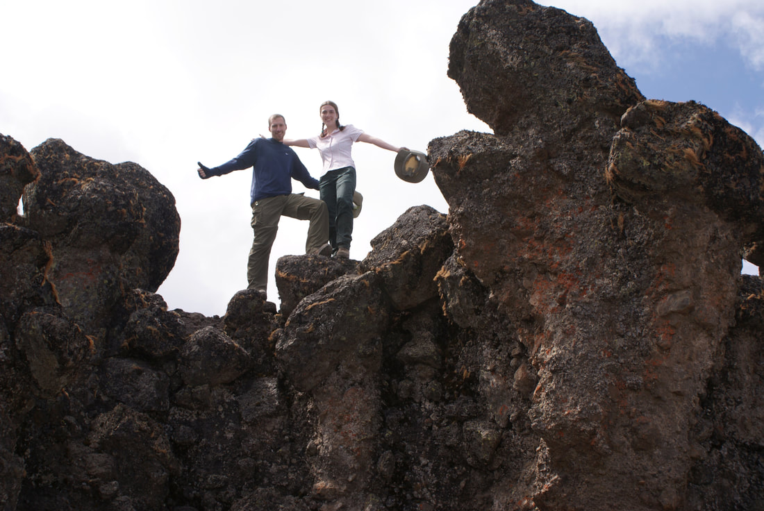
In the end, the biggest obstacle turned out to be just looking at this imposing wall and actually beginning. Once we had started, we realized that yes, it was a very thin trail that only allowed us to travel in single file.... and yes, we could not afford a misstep at all... but other than that, it was doable. After a while, it actually became fun.
|
|
|
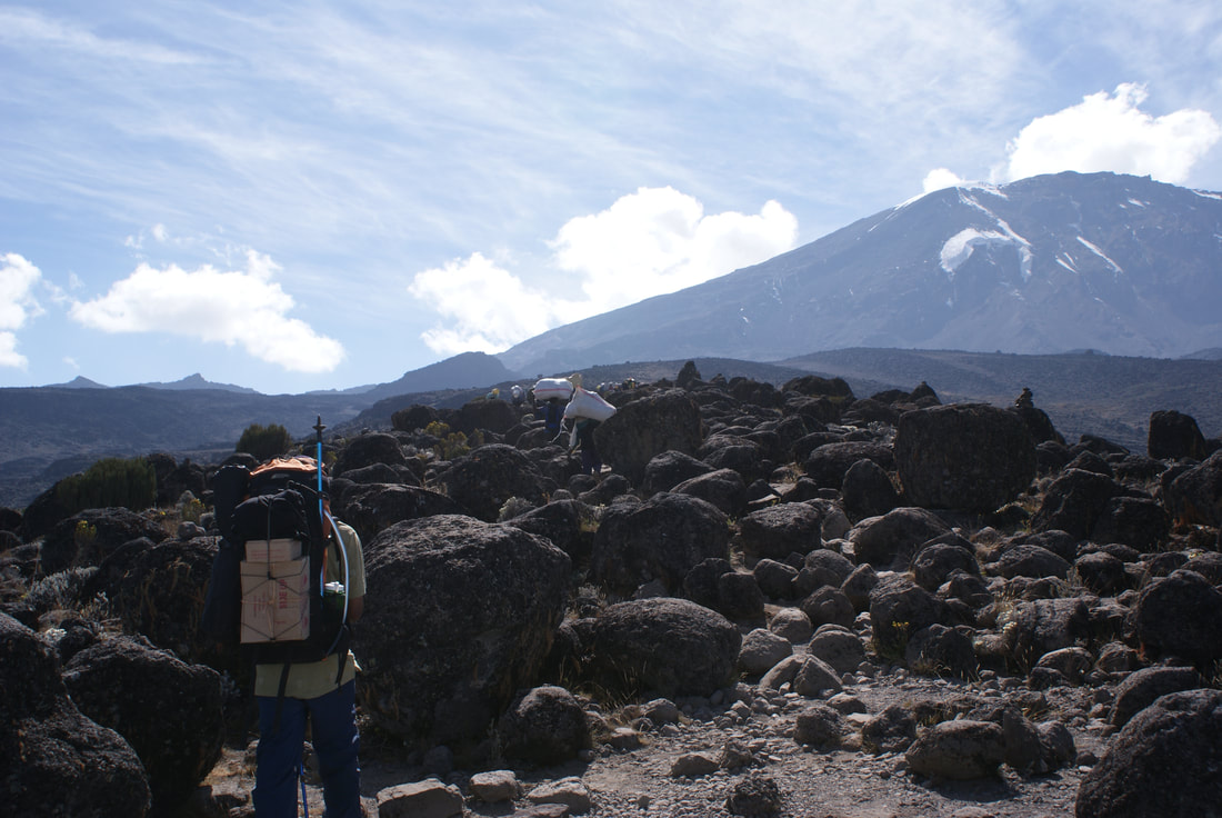
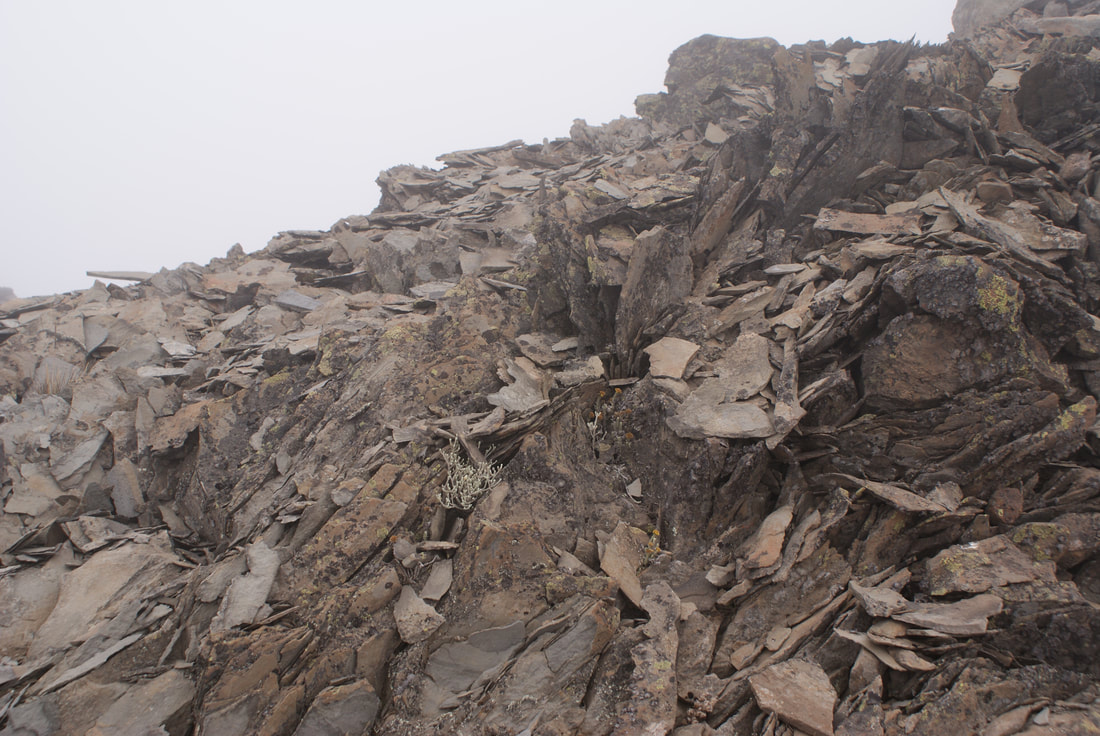
After we had conquered this once imposing obstacle, the landscape became barren once again with little or no vegetation. Our surroundings were mainly composed of brownish-black rock now.
|
|
|
|
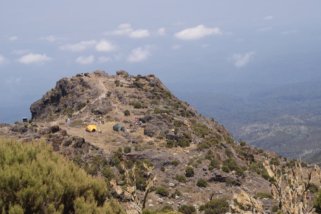
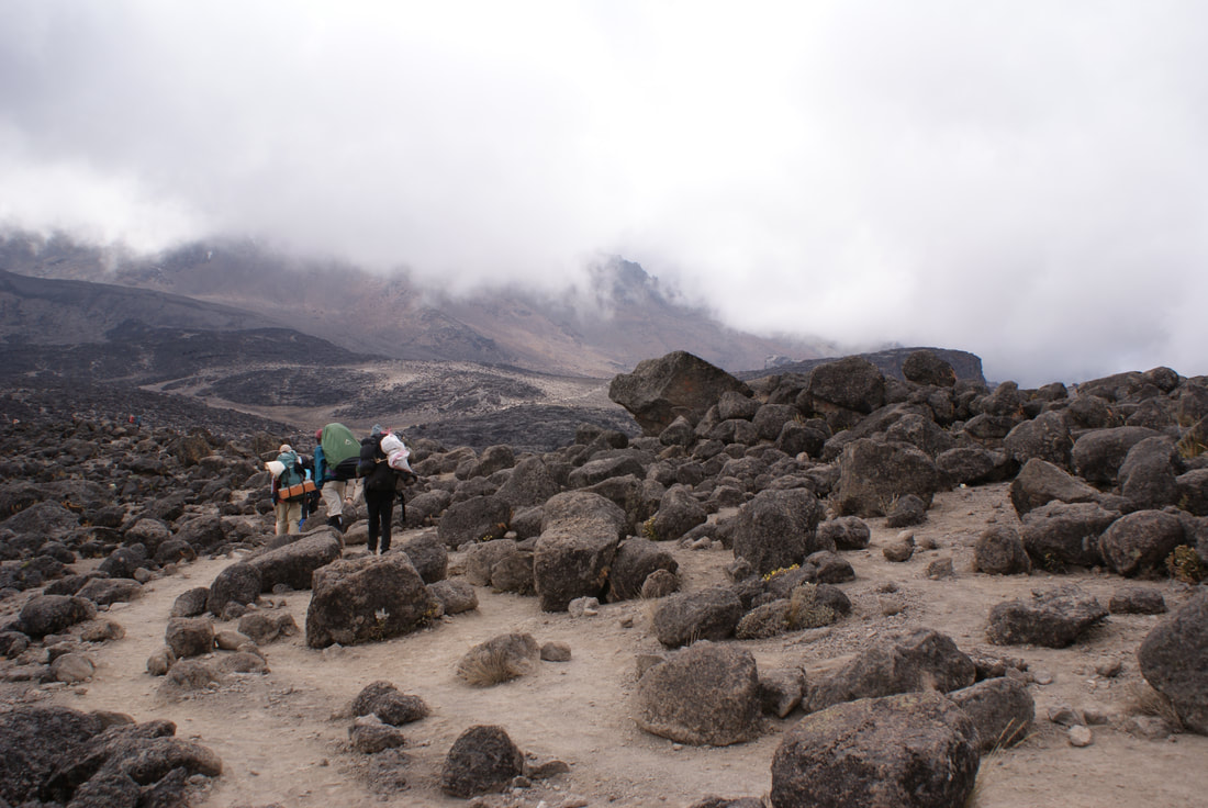
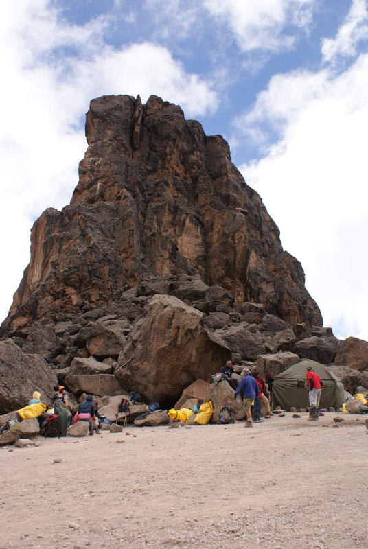
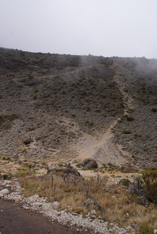
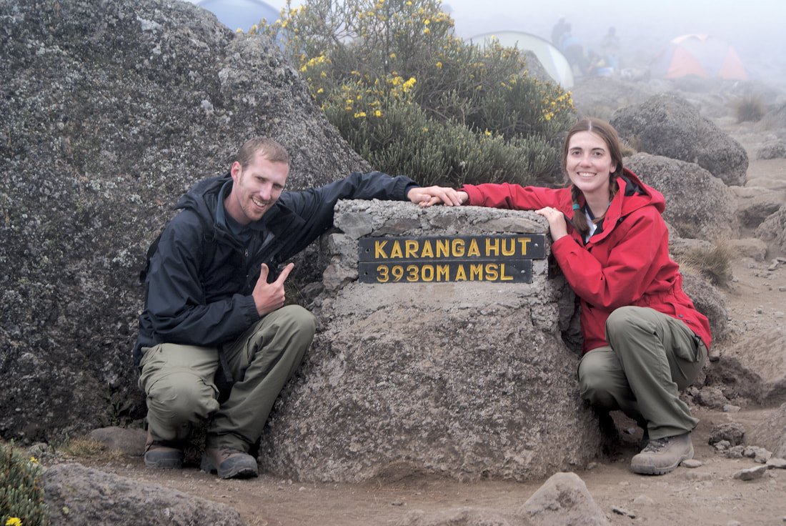
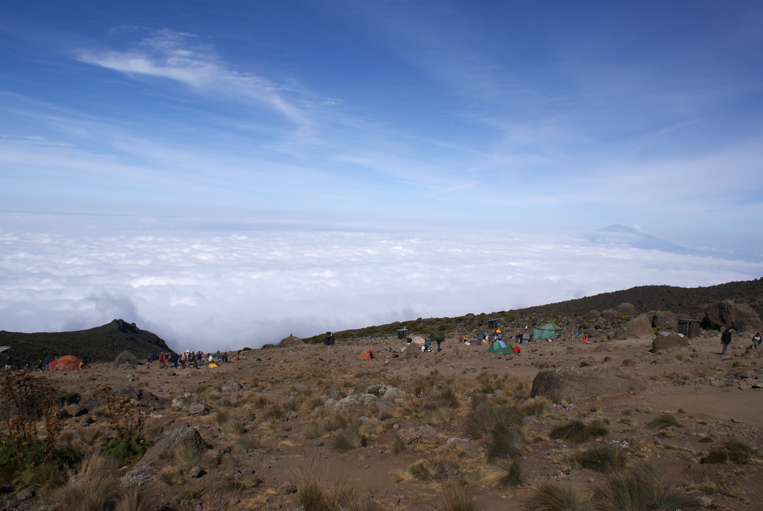
The route then heads down through the Karanga Valley over intervening ridges and valleys, where we stopped to camp. We arrived at camp pretty early. Many people skip camping here and continue for the next 3-4 hours to Barafu Camp (ie, the 6 day route). There are pros and cons of doing the climb in six versus seven days. If you do it in six days, you are closer to getting back to a normal bed and a shower, but it's much more exhausting. If you take the seven-day route, you spend longer on the mountain, dirty and cold, but there is a greater chance of acclimatization and hence a higher success rate of reaching the summit. Plus, you also get to take an afternoon nap at Karanga Camp :-) |
|
Karanga Camp: Staying here makes the Machame Route a 7-day version instead of a 6-day one
Day 5: Karanga Camp to Barafu Camp
•Elevation (ft): 13,100ft to 15,300ft
•Distance: 4 km/2.5 miles
•Habitat: Alpine Desert
We woke up this morning knowing that this was our final day before our ever looming Summit Attempt. It was our last morning to zip open our tent and be greeted by a view like the one below. We did not take it for granted.
•Distance: 4 km/2.5 miles
•Habitat: Alpine Desert
We woke up this morning knowing that this was our final day before our ever looming Summit Attempt. It was our last morning to zip open our tent and be greeted by a view like the one below. We did not take it for granted.
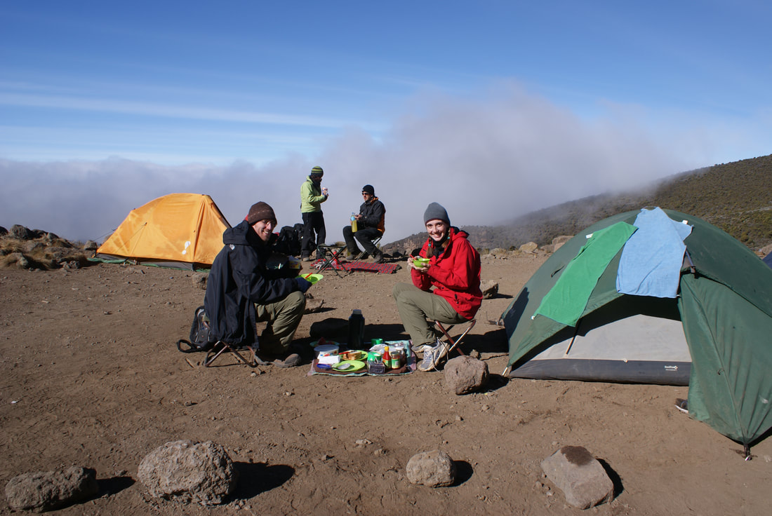
Since we didn't have a long hike ahead of us, we spent some time basking in the glory of being right below Kili. We spent lots of time getting to know our team more, enjoying another leisurely breakfast and just exploring. Our cook hauled out a whole watermelon... a whole watermelon... and prepared it for us. Unbeknownst to us, he had been hiking with that in his pack for five days!! Don't you think that's more like a Day 1 snack?!?
As we began to trek, I snapped this pic and to this day it's one of my favourites. For some reason, it just feels like the true Kili:
no photo-shopped colours, no tourists... just our Kilimanjaro.
no photo-shopped colours, no tourists... just our Kilimanjaro.
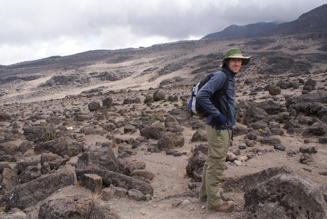
Our walk to Barafu did NOT feel like we were climbing a mountain. It felt like we were on another planet entirely. Or the moon. The landscape had turned to "scree" - loose bits of rock everywhere. This did not afford me a secluded place to go to the bathroom!
Our path went on for miles and miles. We hiked slowly on, the altitude taking our energy away with each step we took.
The path never seemed to end!
We arrived TIRED!
|
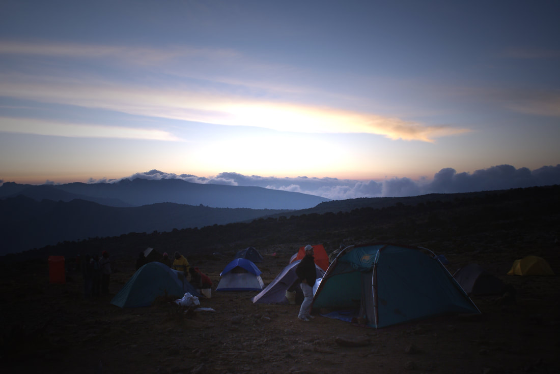
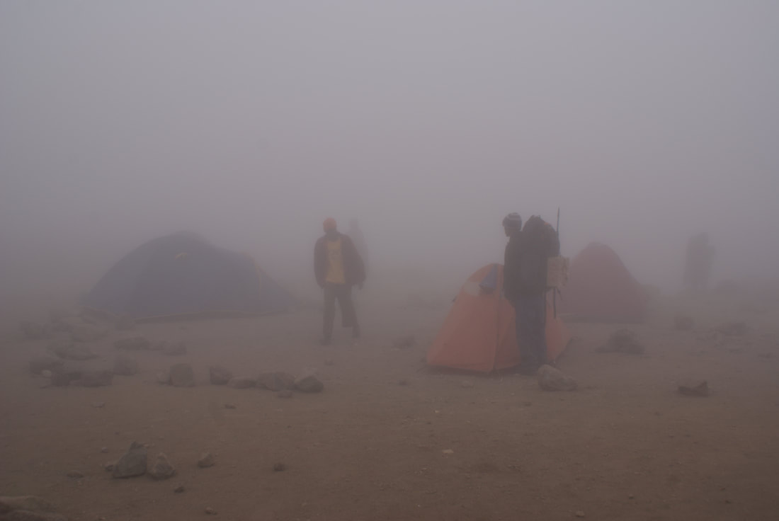
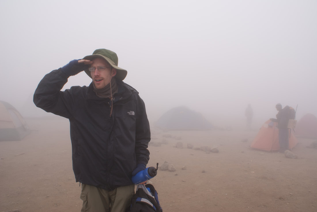
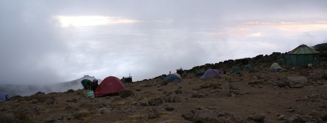
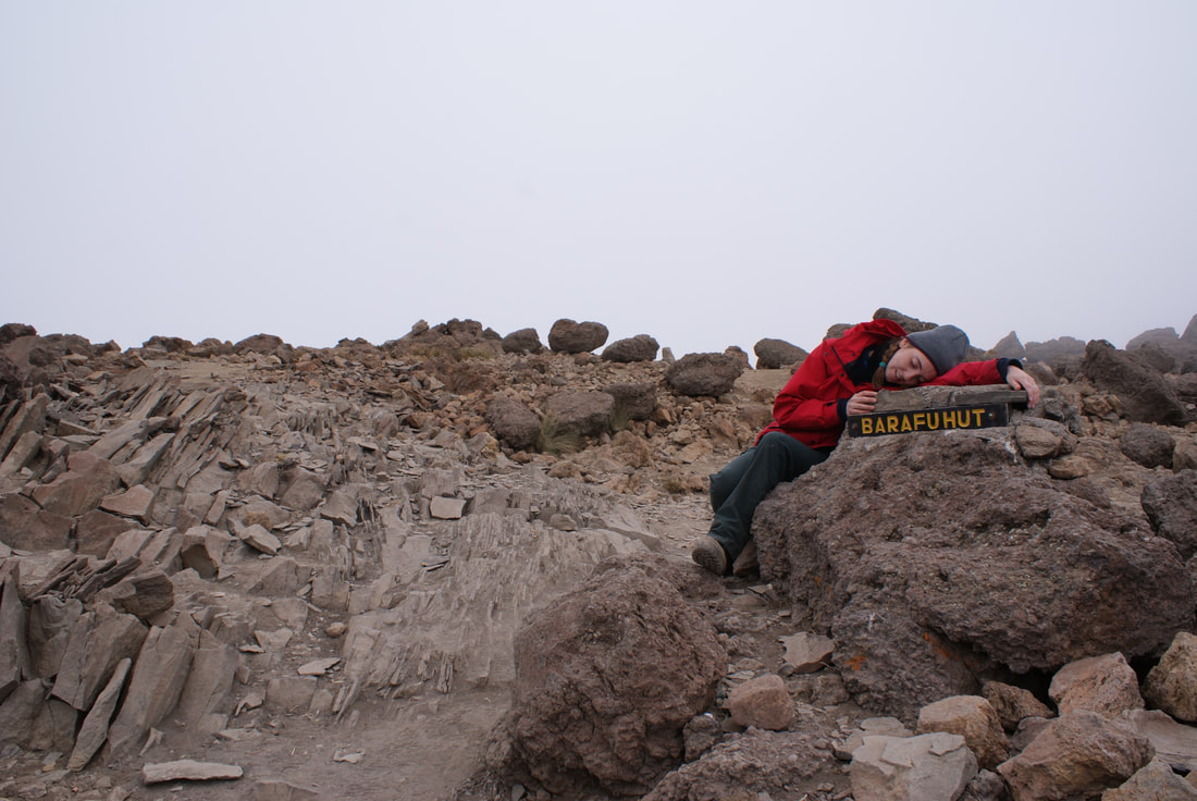
After several hours of moon walking, we arrived at Barafu Camp, our last stop before our summit attempt. Barafu is the Swahili word for “ice," and camp is a barren, inhospitable place full of rocks and tiny patches of uneven ground. Tents are pitched on loose scree along a narrow, stony and dangerous ridge, which is completely exposed to the wind. In every guidebook that we read, the same warning was issued: make sure that you familiarize yourself with the terrain before dark to avoid any accidents, especially walking off the edge of the ridge as you go to the bathroom at night. |
|
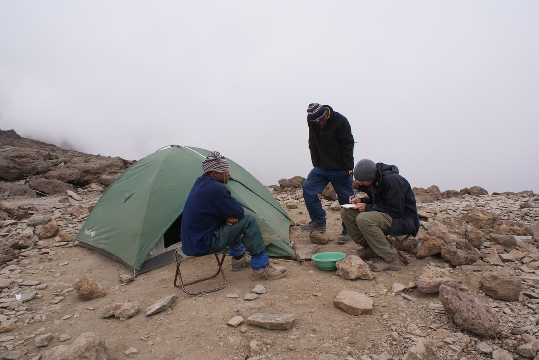
Since Barafu Camp is situated at 4600m, everything took effort. Simply unpacking our sleeping bag, taking off our boots, or trying to find a secluded place to go to the bathroom exhausted us. Nobody looked exuberant around camp. To top that off, hikers were descending from Uhuru peak and walking past us. None of them had smiles. None of them looked even remotely triumphant. Looking back, our problems started that night with our early dinner at 4pm. Having been warned that porters on Kilimanjaro carry unrefrigerated food (of course), we had told our tour company that we were vegetarians. Nobody wants to eat meat that has been carried around for 6 days in a backpack, right? Well, we failed to specify that this included fish. That night, we were served pasta to increase our energy... and fish to give us protein. That fish had been traveling in a backpack for the past six days. Niels and I politely pushed the fish aside, but ate the pasta - which was still covered with the fish sauce. This would later prove to be a huge mistake... Our guides told us to prepare our packs for summiting, and go to bed right after dinner. We checked everything: headlights? Spare batteries? Water? Warm Clothes? Snacks? Yes, we were ready. We went to bed at around 5:30pm, knowing that we would wake later that night at 11:30pm to begin our summit attempt. Our goal lay just ahead of us, and we would begin in a matter of hours. We knew that as much as we wanted to reach the top of Africa, so many hikers have to turn back as the low oxygen levels prove too much for them. The warning signs of acute mountain sickness (AMS) were clear and we were well-rehearsed in them: headache, fatigue, dizziness, vomiting. AMS can then progress to high altitude pulmonary edema (HAPE - symptoms include a bloody cough and fever) or high altitude cerebral edema (HACE - symptoms include inability to walk and loss of consciousness). We knew that we had to judge the onset of these symptoms carefully, because they can occur suddenly and progress quickly. Luckily, AMS can be reversed by descending... but I really didn't want to do this if at all possible. I prepared for bed that night hoping with all my heart that we would both make it up to the peak in good health. That evening, I thought it would be impossible to fall asleep with such a carnival of emotions inside of me... but the altitude did it's trick and we both fell asleep quickly, exhausted simply by the low level of oxygen around us. |
Tents pitched right next to a sheer cliff
Niels taking a "shower"
Niels drawing sketches of our team!
|
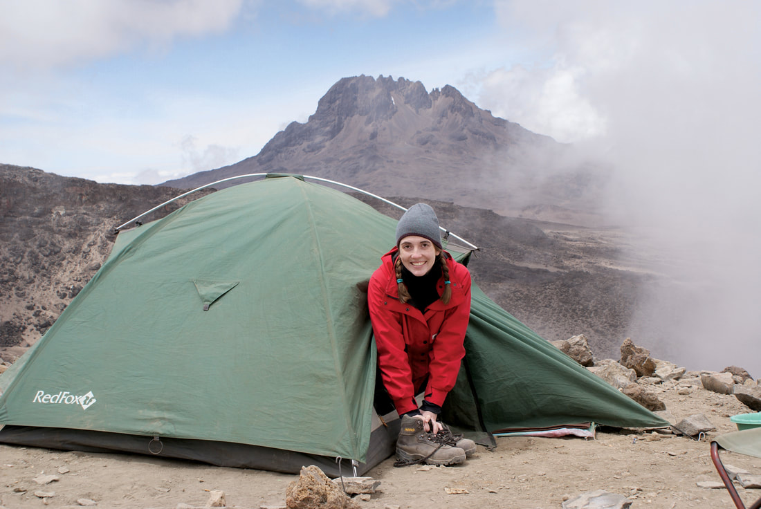
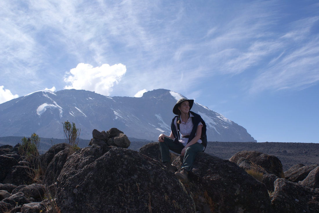
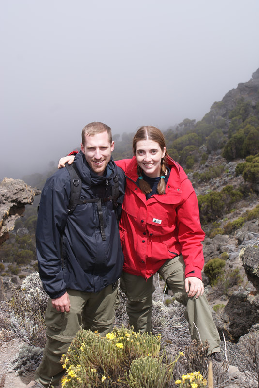
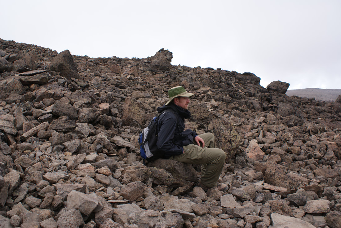
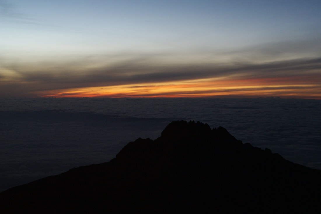
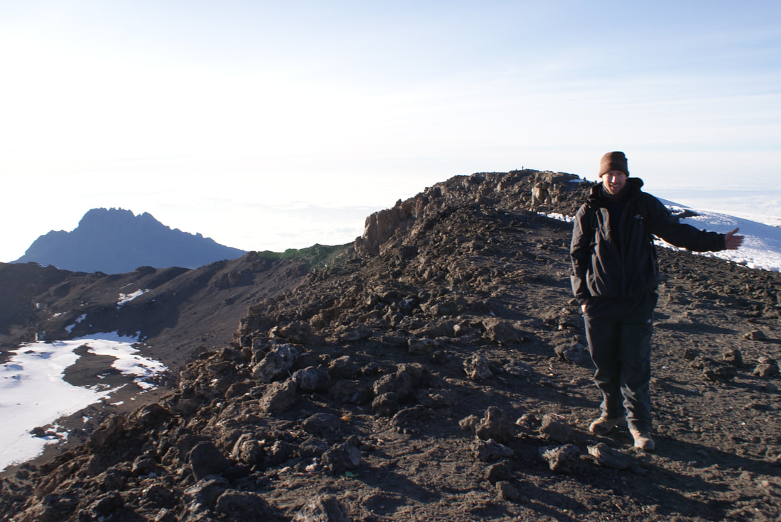
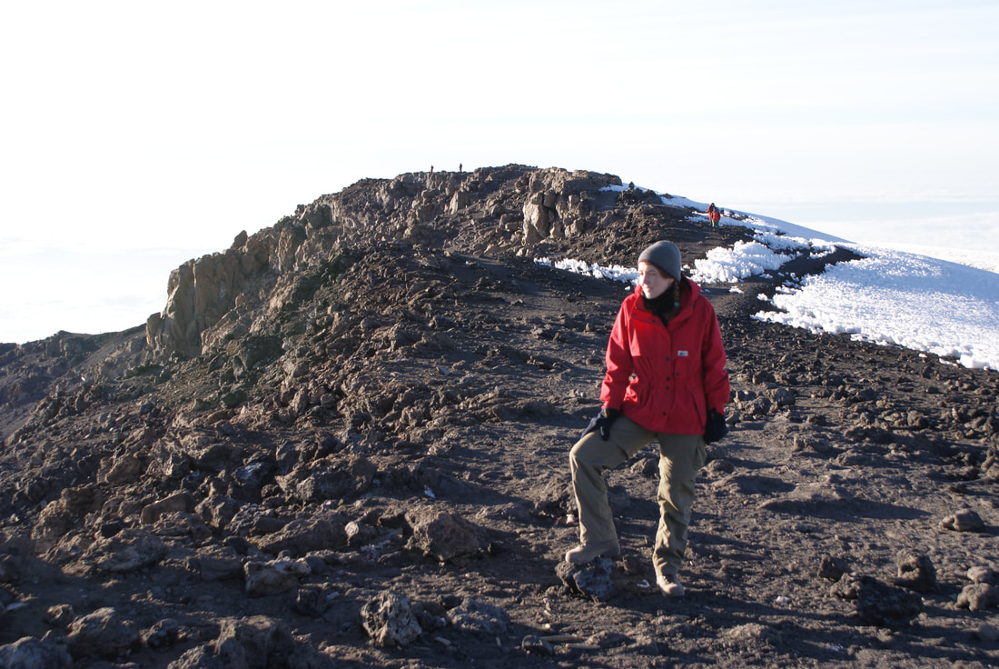
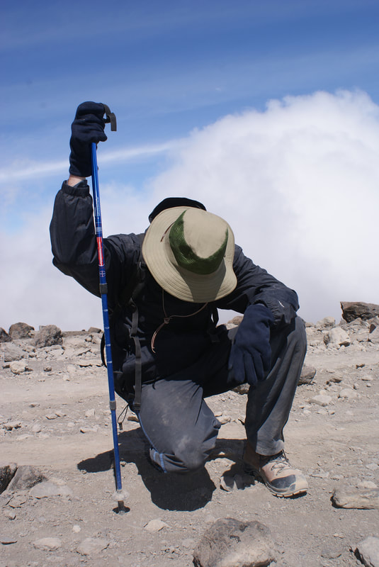
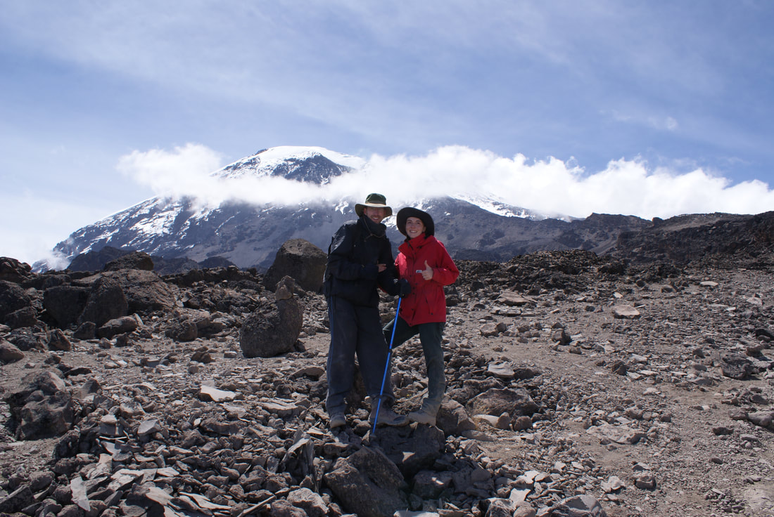
Ready for the next day's hike! That is Mawenzi Peak behind me, one of the three volcanic cones on Kilimanjaro.
Day 6: Summit Day
Barafu Hut - Stella Point - SUMMIT - down to Mweka Hut
•Elevation (ft): 15,300ft to 19,345ft (and down to 10,000ft)
•Distance: 5 km/3 miles ascent and then 12 km/7 miles descent
•Habitat: Arctic
•Distance: 5 km/3 miles ascent and then 12 km/7 miles descent
•Habitat: Arctic
|
Our guides woke us up at 11:30pm that night with a "breakfast" of tea and biscuits. "Habari gani?" they asked. "Nzuri" - good, we replied. We were on the trail by midnight.
As we began the trek in the pitch black of night, I became aware of what would become one of my biggest obstacles that day: It. Was. Freezing. I was wearing all my layers, warm hiking socks and proper hikers, but man - I could NOT feel my feet. This 'Canadian' girl was no match for the plummeting temperatures on Kilimanjaro at night. |
|
The path up was a steady zig zag that traversed the mountain... ten steps one way, turn around, ten steps the other. Repeat. As I looked up, I could see a row of gently swaying lights ascending the mountain. I couldn't tell where the headlamps stopped and the stars began. I was afraid to look up too far in case I lost my balance, and it was dizzying to look down and not know where you were on the mountain. It was so dark. It was so cold. It was not fun at all.
I sat down with my head between my knees several times. "Habari gani?" they asked. "Mbaya," I replied. I did not feel good anymore. Our guides must have had endless patience, as did Niels. He tried to warm my hands between his and urged me to stand up, take ten more steps, keep going. The words "Pole pole" - the Swahili translation for "Slow, Slow" - were whispered over and over as we climbed, and climbed and climbed. Ten steps left. Stop. Turn. Resist sitting down. Ten steps right. Stop. Turn. Keep going.
We did this for six hours.
That night never seemed to end.
Looking back, I remember the first hour, as well as the last one before the rim, but neither Niels or I have recollection of the middle four hours. I think we just went on autopilot. No thinking... no talking... just miserably putting one cold foot in front of the other.
We honestly don't have a lot of photos of the trek up, because it was too exhausting to take out the camera (ok, and we were hiking in the pitch black of night). Any extra energy went to drinking water. There was no place to go to the bathroom, but nobody cared. Not many people were looking up anyway.
|
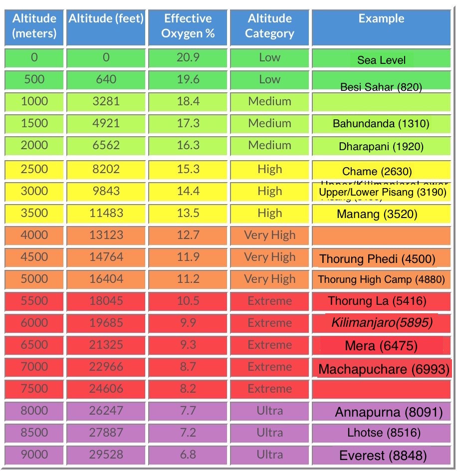
Mountain medicine recognizes several levels of altitude that reflect the lowered amount of oxygen in the atmosphere. On the table to the left, I have climbed all the yellow and orange sections, including the red Thorung La. Once again, I found myself in the "Extreme Altitude" section of the table. WHY do I do this to myself? I can't believe how hikers ascend even farther than this, into the purple "Death Zone" - dubbed so because the amount of oxygen is no longer sufficient to sustain human life. I personally have viewed both Annapurna and Everest up close... and that will be quite enough thank you. Don't need to climb them - just need to look at them :-) |
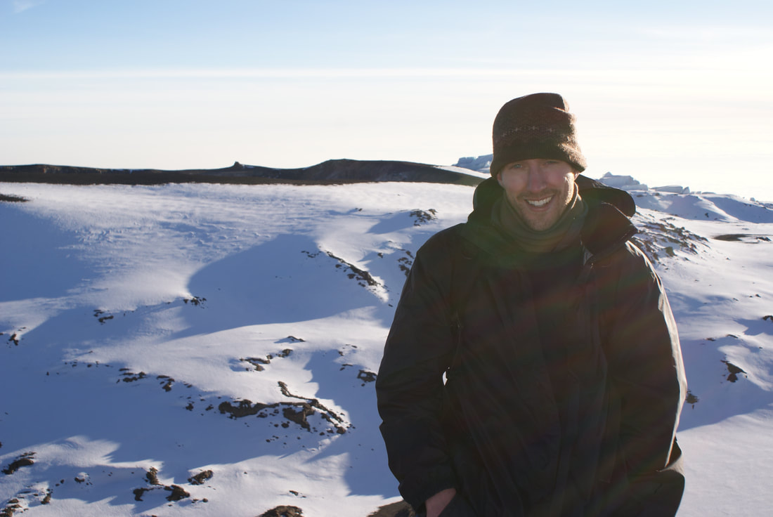
Stella Point
Our goal was to reach Stella Point (the top of the crater rim), by sunrise. Then we could warm up with a snack and continue along the crater rim to the highest point, Uhuru Peak.
About three quarters of the way up, we saw two guides descending the mountain extremely quickly. They were holding up a girl between them, whose head lolled and feet dragged. She was unconscious and in bad shape. Luckily, she had two strong guides carrying her fast down from the rim. I thought back to when I was hiring a team from Canada - so concerned about reducing the number of guides and our costs - completely unaware that so often it was these very men that might just save your life. As we neared Stella Point, I really didn't think I would make it. That last push up to the top of the rim is the toughest - it's both mentally and physically overwhelming. My stomach felt 'fishy' from our dinner earlier that night and I was so nauseous. We were walking over loose scree and dust, on such a steep gradient, with less than 50% oxygen in the air. The path never seemed to end. Our guides encouraged us to walk faster - we were supposed to 'enjoy' the sunrise at Stella Point and already the glow was peeking out from the horizon. They said "Keep going! You're doing great! Almost there!" I looked appreciatively at them - and then promptly threw up. Since vomiting is a sign of AMS, everyone was immediately concerned. I honestly don't know if it was the altitude or our dinner of fish, but it's probably a safe bet to say it was both. Wanting to continue, I assured everyone that I was fine, but our first warning sign had appeared and we were on the alert. I used all my energy to push myself up the last stretch to Stella Point. We finally made it by 6am! We were on the crater rim! Our guides congratulated us, and we stopped to view the sunrise from (almost) the top of Africa. After a snack and warm tea, I felt much better... except for the fact that I could barely breath and we weren't at the summit yet. |
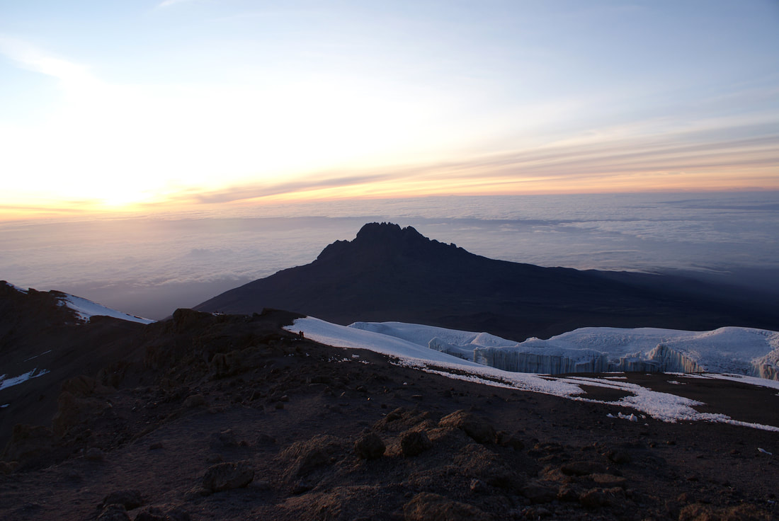
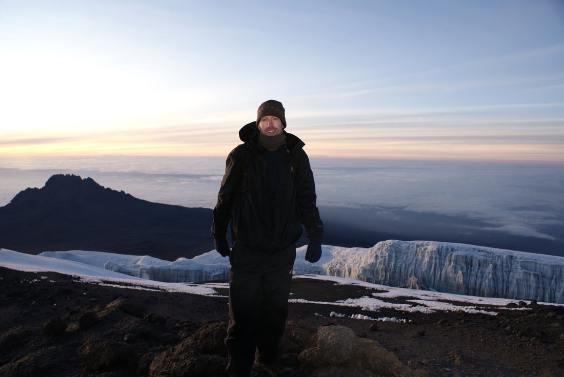
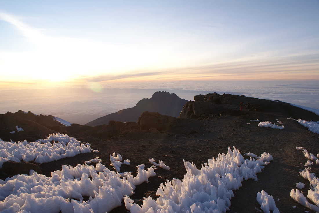
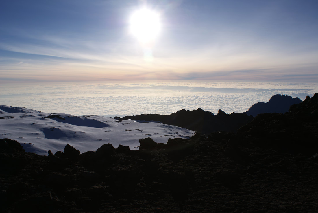
This first peak of a sunrise behind Mawenzi Peak
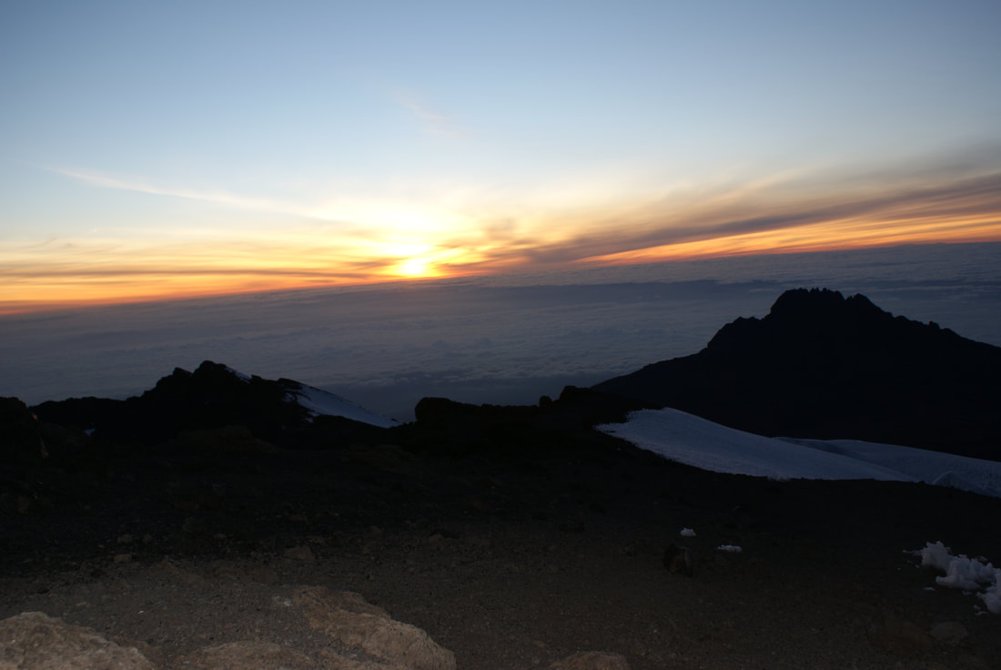
Good morning Africa!
|
I will never get tired of looking at this "sea of clouds"
I've seen many a gorgeous sunrise, but I have to say that this one was the best
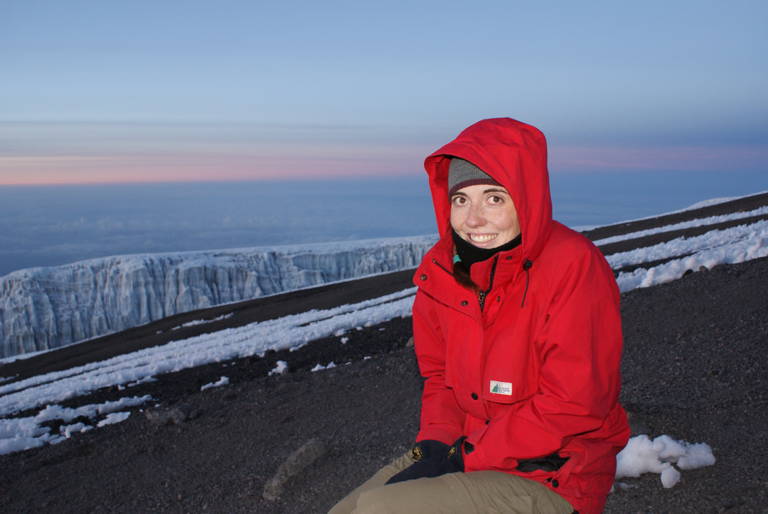
Brrrr... at least the tea and snack at Stella Point helped me warm up!
|
You can see the glaciers behind us
|
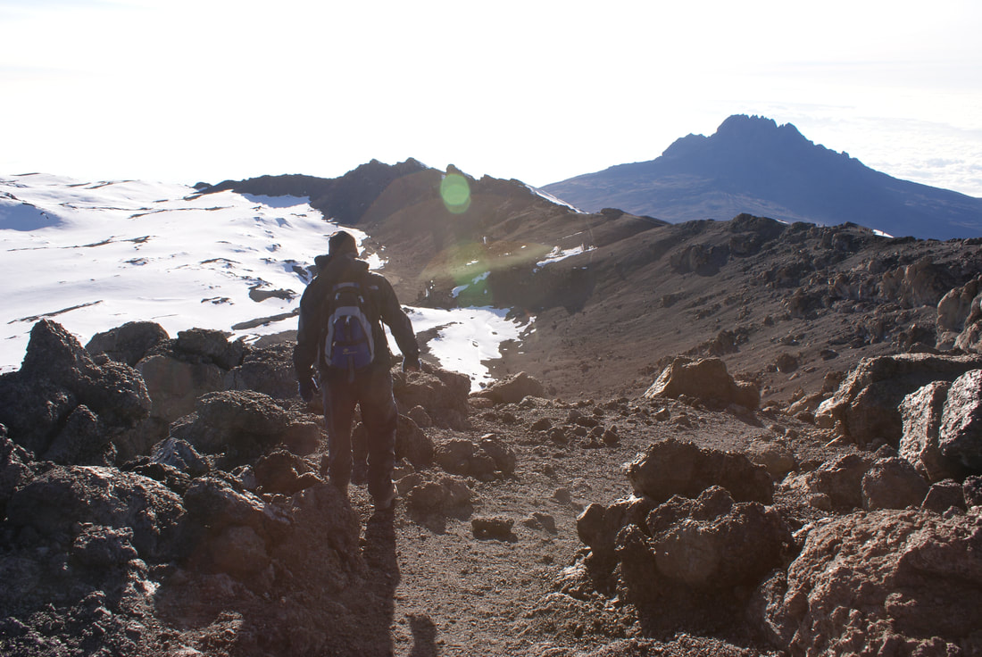
Uhuru Peak
After Stella Point, we still had another one to two hour's walk around the crater rim to Uhuru Peak. I had to dig deep for the energy to push for the summit, but we were so close. Many climbers stop at Stella Point and turn around - I was not going to be one of them.
I remember that walk to Uhuru Peak well. It was exhausting. Every step took an epic amount of effort. With every breath we took we were barely rewarded with oxygen. Our pace was painstakingly slow. Step, breath. Step, breath. Sit. Step, breath. Step, breath. Lean over to gasp for more air. Step, breath. Step, breath. Continue.
I remember that walk to Uhuru Peak well. It was exhausting. Every step took an epic amount of effort. With every breath we took we were barely rewarded with oxygen. Our pace was painstakingly slow. Step, breath. Step, breath. Sit. Step, breath. Step, breath. Lean over to gasp for more air. Step, breath. Step, breath. Continue.

I had to remind myself to LOOK UP. I was on Kilimanjaro! The top of Africa! I hate to say it, but it was just too easy to keep looking at my feet, willing them to move. It's a good thing Niels thought to take photos - it barely crossed my mind. I was in survival mode, and all energy was reserved for walking. Trust me - I look fine in the photos, but I was definitely feeling the altitude at this point.
I'm in all the photos because only Niels had energy to take them!
|
Getting there... you can see the sign in the distance!
|
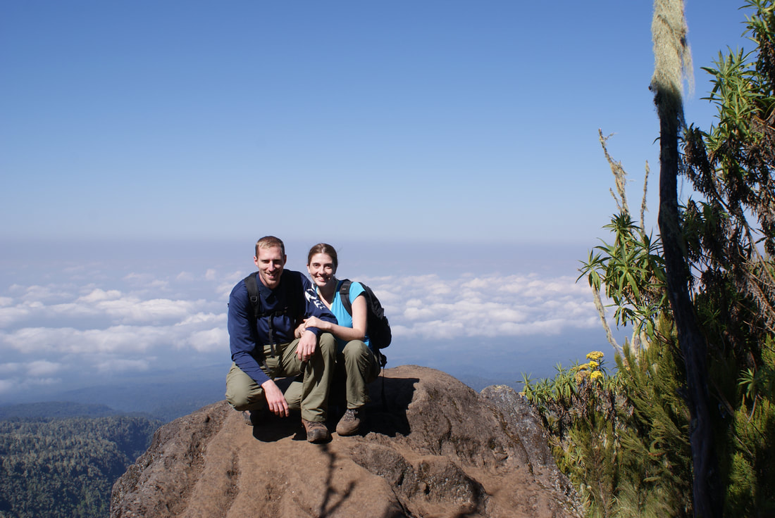
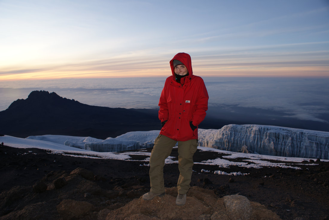
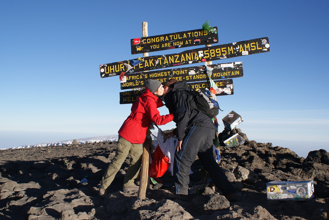
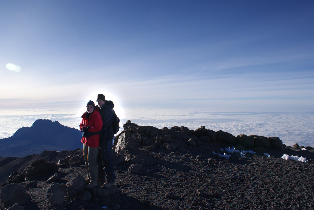
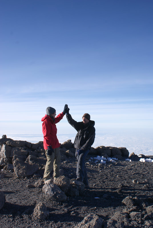
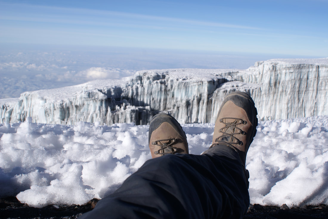
We reached Uhuru Peak and celebrated with a few photos, high fives, and a high altitude kiss. It was, in the end, exhilarating. We were standing on the highest point of Africa, and the tallest free standing mountain in the world.
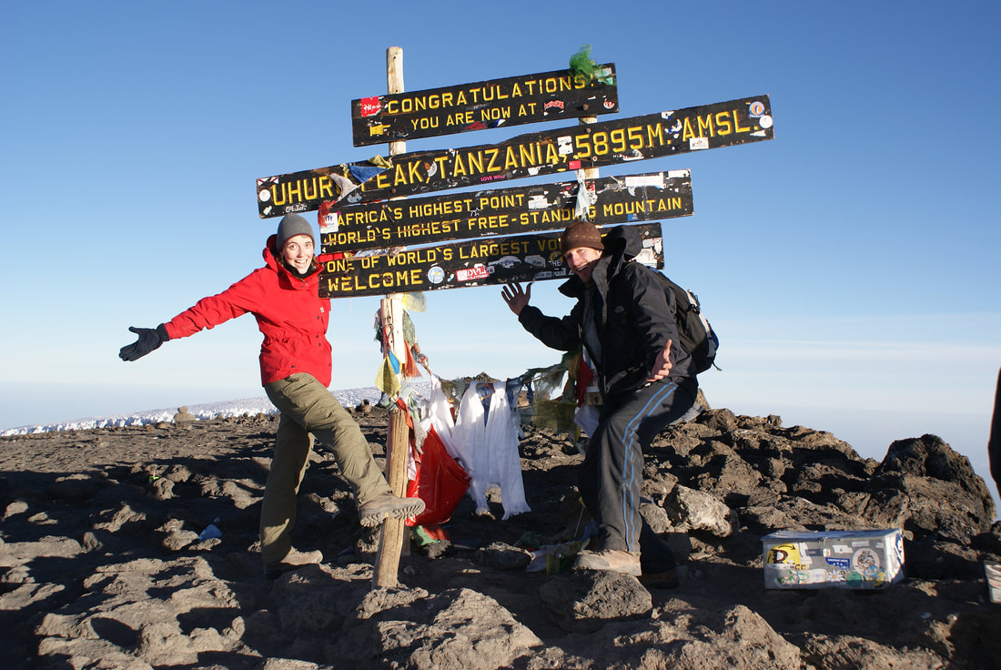
We made it!
5,895 meters/19,341 ft
|

|
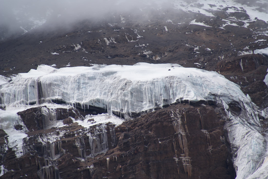
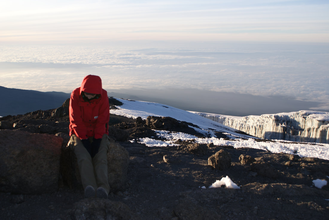
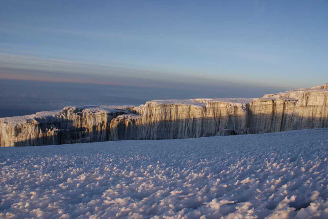
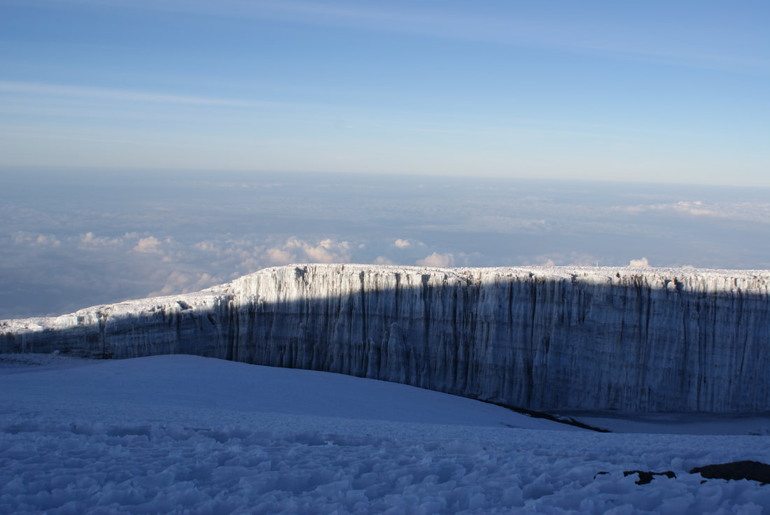
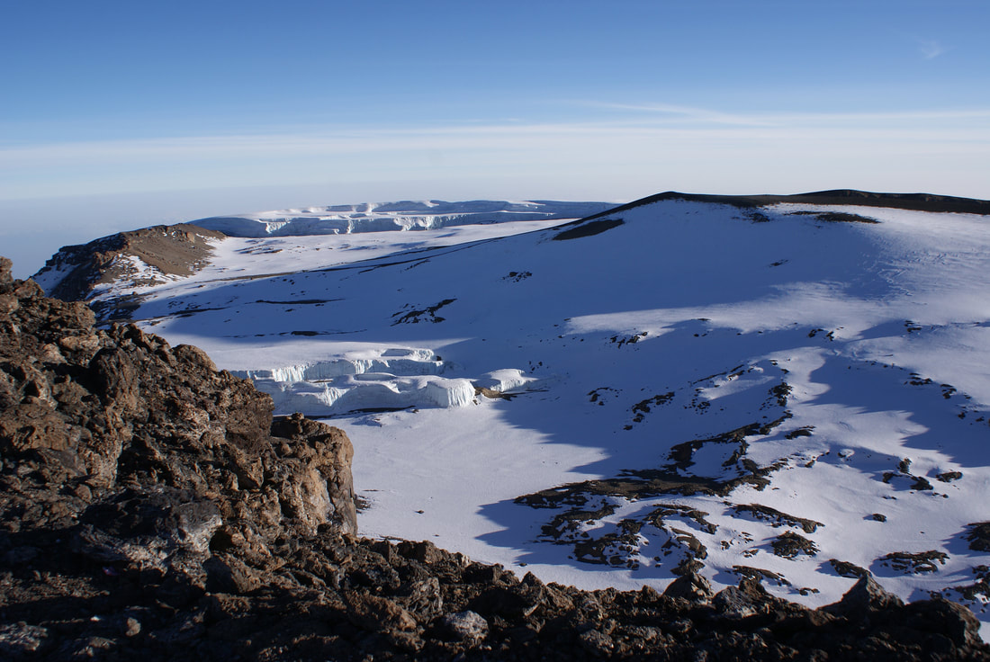
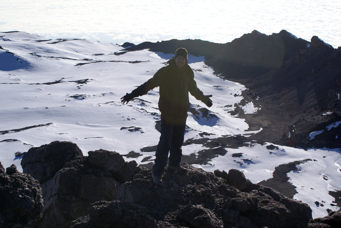
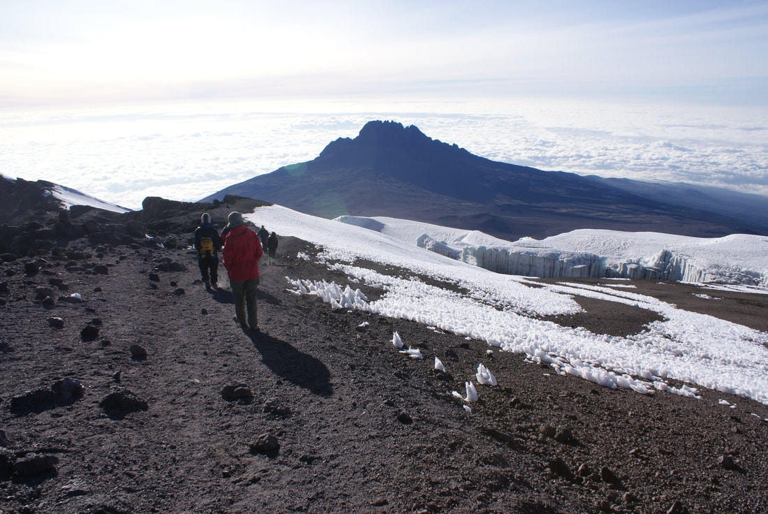
After successfully summiting, we gained a bit more energy. We took some time to tour the glaciers which were quite tall and majestically towered above us. Apparently these glaciers are rapidly melting, but were surprised to find that they are still several stories high.
|
|
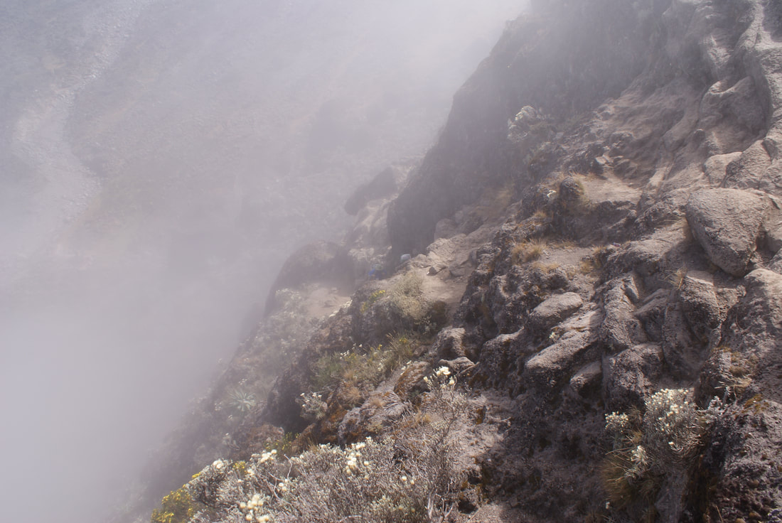
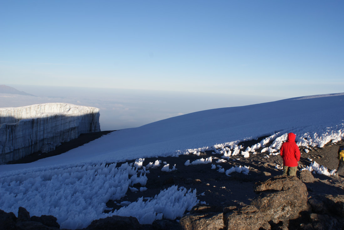
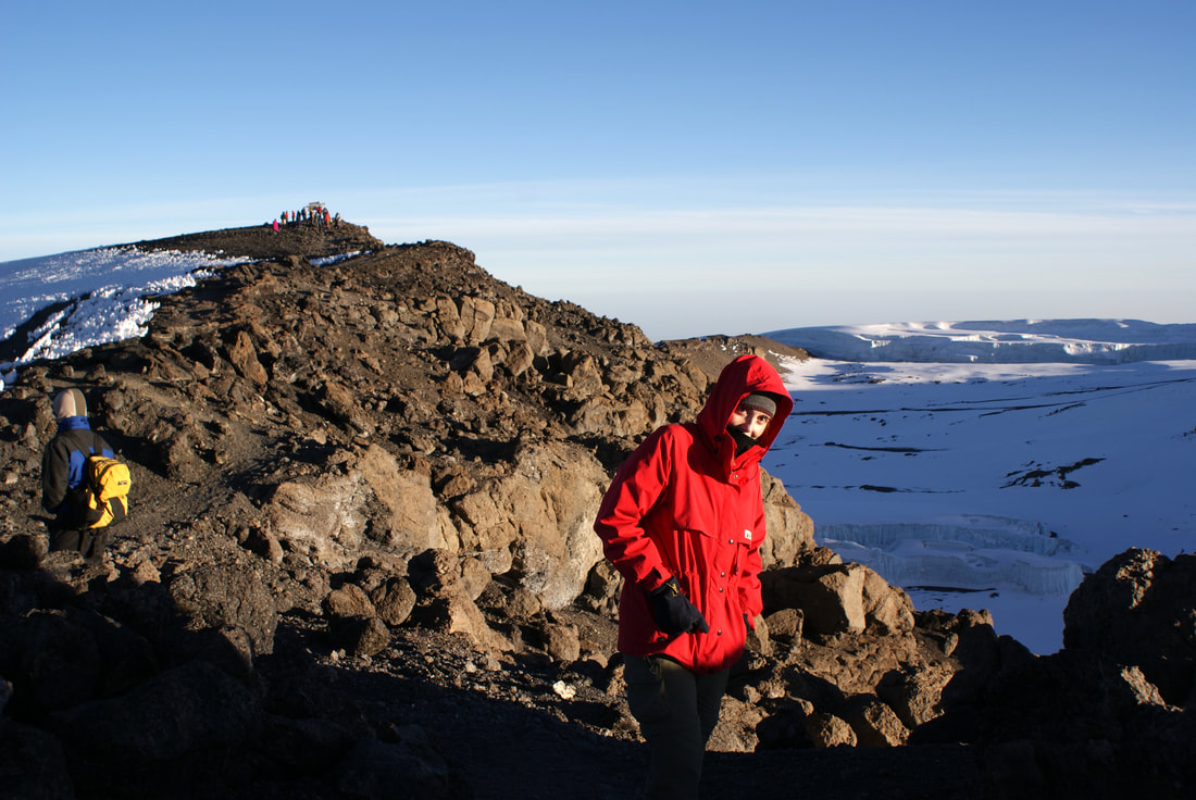
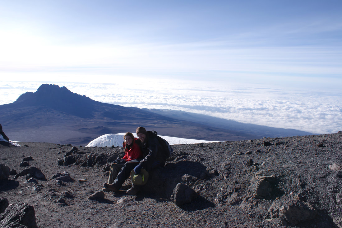
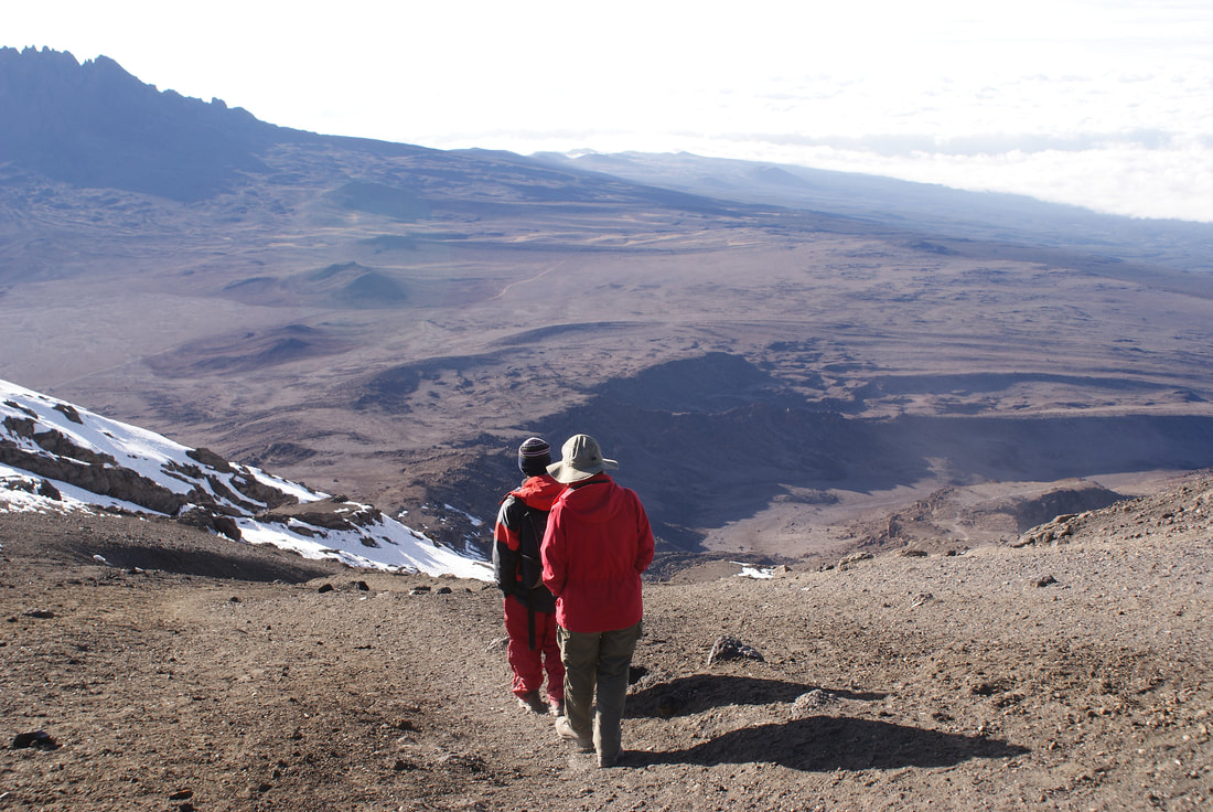
We also explored along the crater rim...
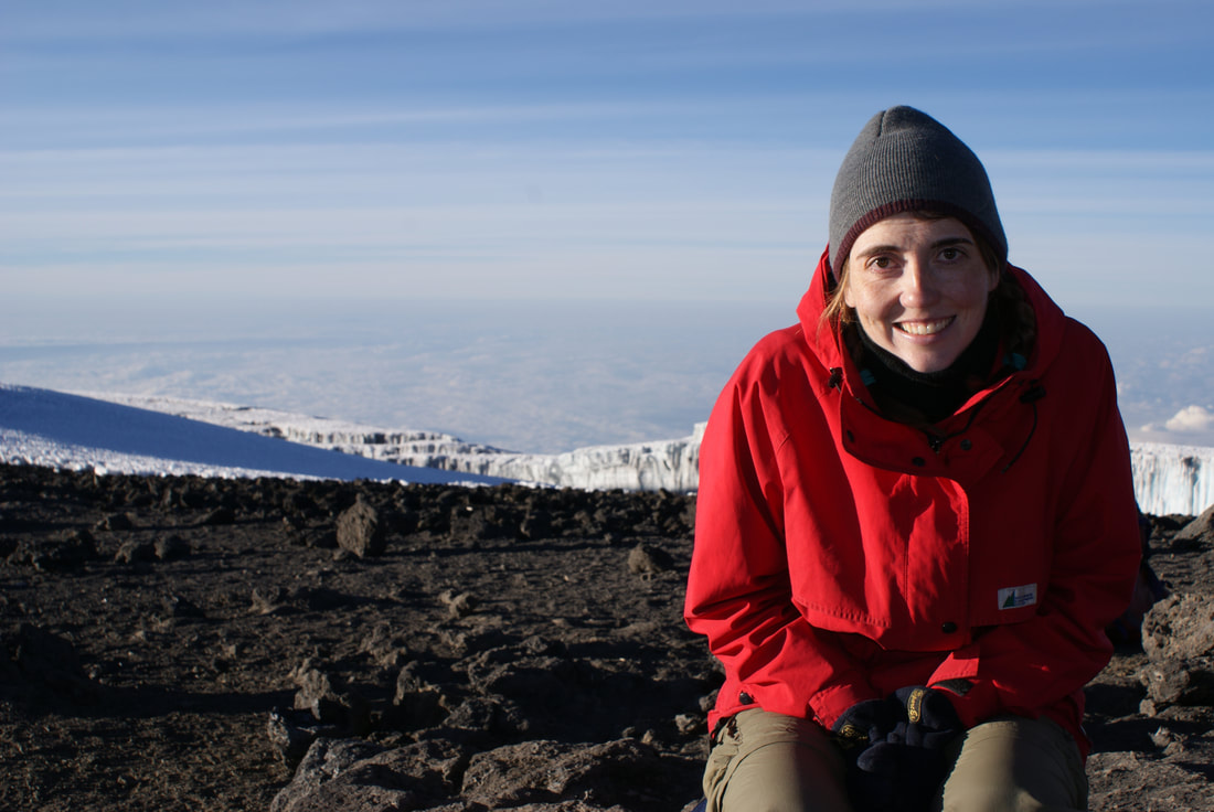
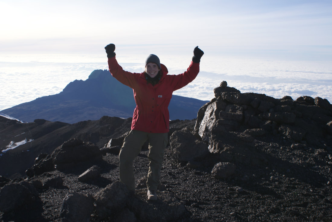
What a special moment - on top of Africa - to spend with my husband.
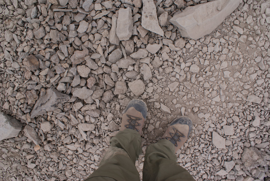
In the end, we couldn't spend too much time at the summit as we knew the big ascent would catch up to us and we wanted to avoid altitude sickness as much as possible. Descending counteracts the effects of the ascent, so we knew we had to descend quickly and sleep lower tonight than we did last night. Before we left the summit, we took the obligatory feet picture:
Kwaheri Kilimanjaro. We will miss this view!
I don't want to leave (although it will be nice to breathe again...)
We hiked back to Stella Point together, partly in a state of disbelief that we had made it... and now had to leave.
|
It was shortly after this that Niels began to feel the affects of the altitude... or dinner. He was hiking quickly and I couldn't keep up. I asked him to wait - and he looked at me and said "I need to get down now." I nodded - we both knew that his body needed to feel the relief of descending. Niels shot down out of sight like a bolt of lightening and our assistant guide hurried after him, trying to catch up. I was left with our main guide, Shawn, and a thankful heart that we had indeed hired two guides. |
|
The path down Kili is different to the one going up, and I didn't expect this. There is no gentle zig-zagging ascent, just a scree slope to ski down. Yes, I mean ski. Each step that I took was followed with a good meter of involuntary sliding. It was so much fun and you could cover ground very quickly. This was in complete contrast to the way up - our steps were now effortless as we skied downhill, not on snow but on loose ash... not with skis but with hiking boots. Luckily, we knew enough to cover our faces with a handkerchief to avoid inhaling the volcanic dust that is kicked up all around you in the process. If you don't do this you can develop a wicked cough, which is your body literally coughing up volcanic ash from your lungs.
I have to say, I managed to descend very quickly. Skiing down was fun and I just had to really focus on trying to maintain my balance. There were a few times that I felt like I had lost control, but I just went with it. I think I fell a few times, but really... that just meant that I 'bum slid' a few meters on loose scree.
I wish I'd taken more photos of the descent. The best video I can find is here, where you can see how fast he is going. I wish I'd had a Go-Pro. What was I thinking? Oh wait - I probably wasn't. At that altitude everything slows - even digestion and brain function - so that your body can put all it's effort into breathing.
Starting down with Shawn, my guide
|
I used the zoom to see our path down to Barafu
|
We did that descent in lightening speed (about two-three hours). I met up with Niels again mid-afternoon at Barafu Camp by our tent. He was not looking good at all. I felt much better, but I could tell that now he was suffering. We were supposed to eat lunch at Barafu and then descend to "sleep low" at the next camp, Mweka. We had to keep descending to combat that immense altitude we had gained that morning.
That being said, Niels knew that his system needed sleep. He threw up at Barafu Camp and did not feel good. He went into the tent to sleep, against the petitioning of our guides. I remember physically blocking the way between our guides and Niels in the tent. "He needs to sleep!" I said. "He needs to descend!" they said. In the end, I won and they said we could sleep for a few hours. They were very concerned about us and wanted to get us down to a safer altitude. I climbed into the tent next to Niels and curled up. After hiking all through the night and all morning, our systems needed one thing: rest.
Looking back at Kili from Barafu Camp
|
We just climbed that!
|
After a nap, we packed up our tent and gear, gladly saying goodbye to Barafu Camp. No pleasant memories were made there! The hike down to Mweka Camp took us right down through the moorland and into the upper forest zone. Walking down the path should have been easy, but we were weary from the day and our legs were weak. It took us much longer than it should have. "Hey! We did it!" I offered up to Niels. "We're never doing that again," Niels responded back to me. Don't worry - this was short lived. A mere two days later I caught Niels telling another couple in Moshi: "Kili wasn't that hard - it was amazing actually - you guys could do it!" I think we both look back at our hike through rose coloured glasses, preferring to forget how difficult that Summit Day (night?) actually was.
We arrived at Mweka camp at 7pm that evening, which was almost twenty hours of hiking (with a long nap in there!). We were so tired. That evening we didn't feel like dinner, but since we had passed up lunch and really hadn't eaten a meal since that dreaded fish dinner, our guides forced us to at least have soup. We obliged, and then fell blissfully asleep.
Day 7: Mweka Hut to Moshi Town
•Mweka Camp to Moshi
•Elevation (ft): 10,000ft to 5,400ft
•Distance: 10 km/ 6 miles
•Habitat: Rain Forest
We awoke feeling refreshed and a lot better. Tiredness seemed to now be permanently woven into our bones, but we managed the scenic hike out of the rain forest fairly well. The stretcher picture below is fake, but Niels had fun posing for the camera! Those gurneys are placed along the trail in case a guide has to hightail it out to the hospital with their hiker.
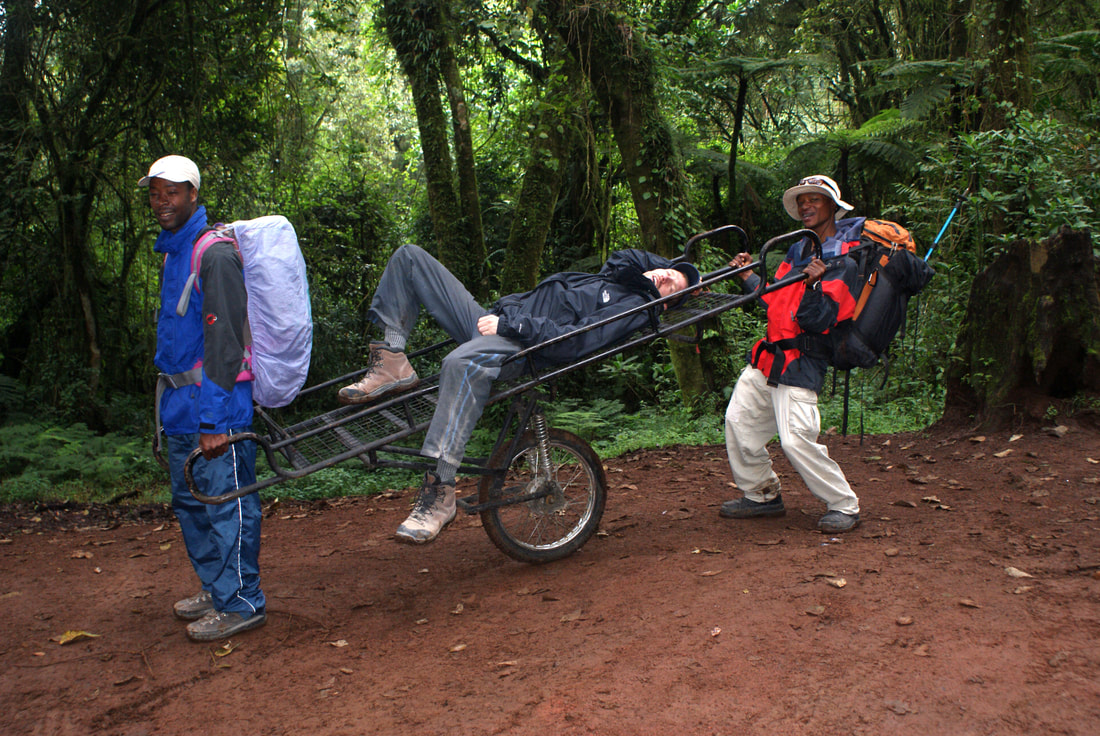
With a runner in front and back, those gurneys could actually travel FAST!
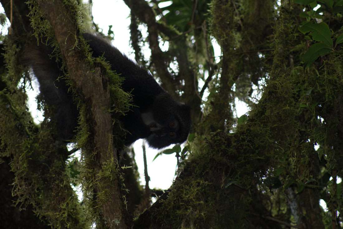
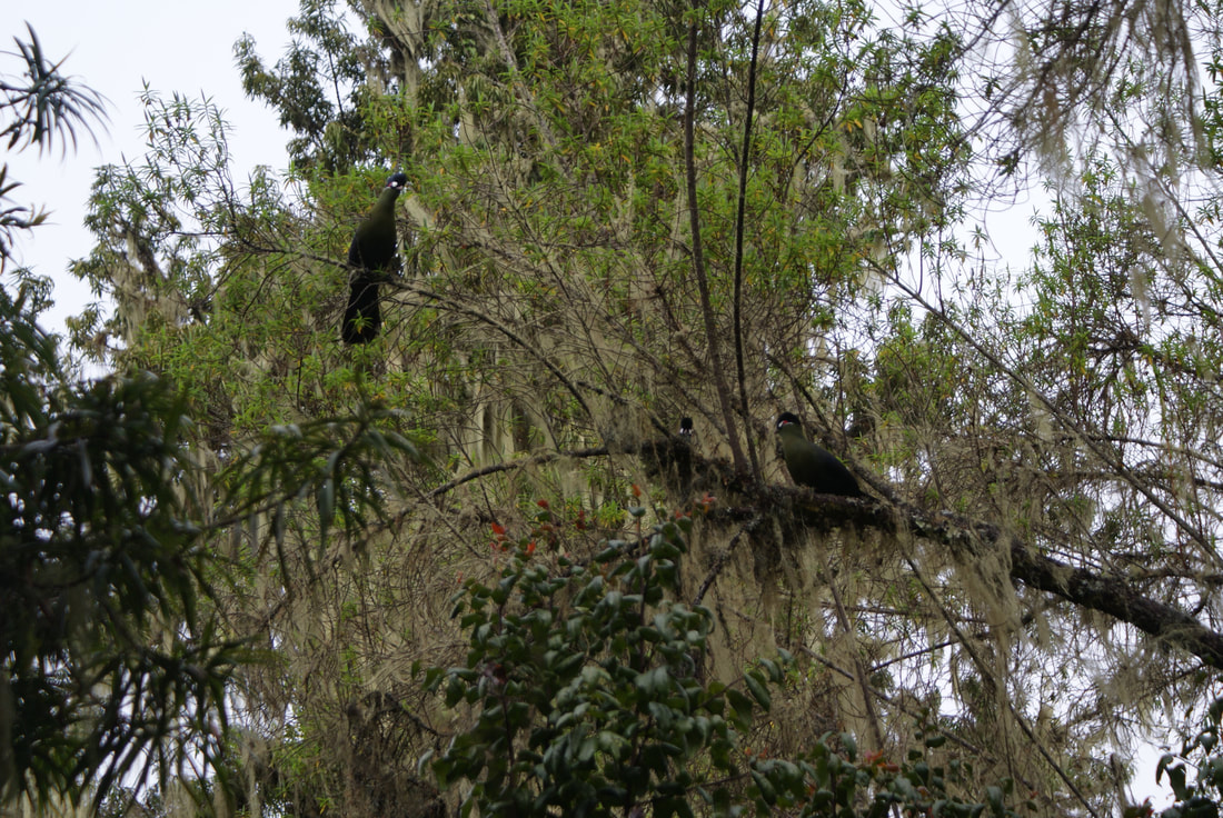
We enjoyed being back in the rain forest, hearing the birds and even an occasional wild monkey!
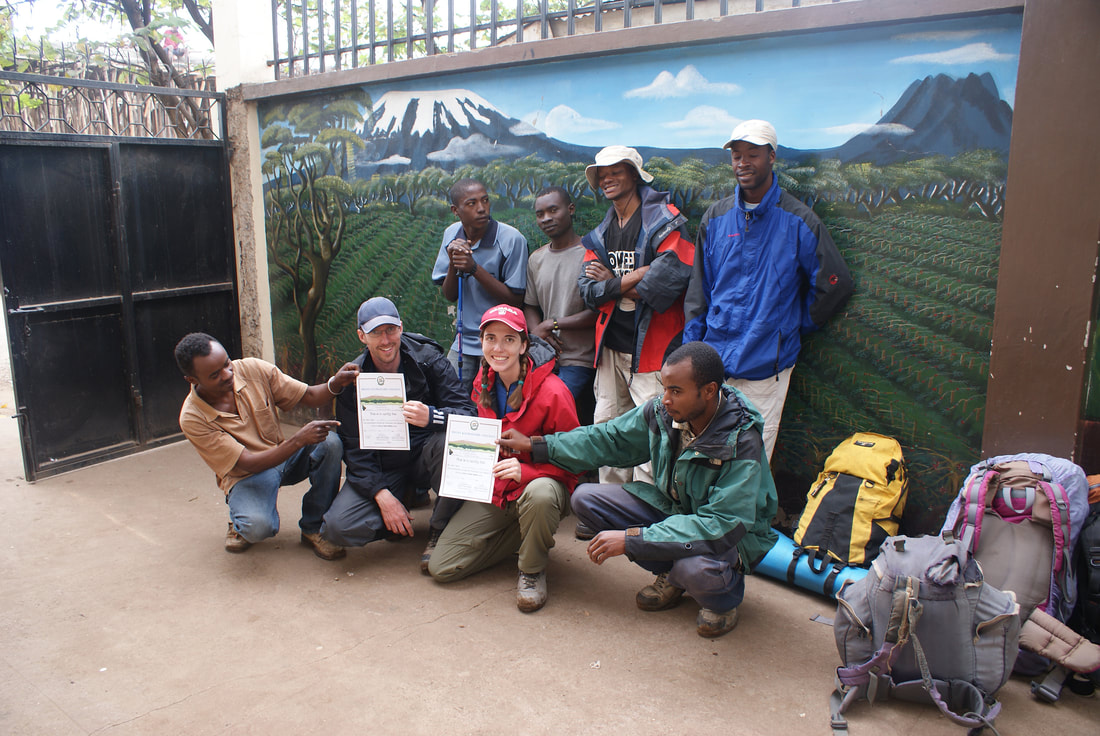
We finally arrived at the Mweka Park Gate and signed our names and details in the register there. This is also where we received our summit certificates! Climbers who reach Stella Point (5739m) are issued with green certificates and those who reach Uhuru Peak (5895m) receive gold certificates. Whoohoo! We got gold!
|
|
From Mweka Gate we continued down for another hour into Mweka village. This was where our hiking adventure officially ended. We gave our team their tips (they were amazing!) and said our goodbyes. Then we made our way back to Moshi for a long overdue hot shower, hot dinner and warm bed!
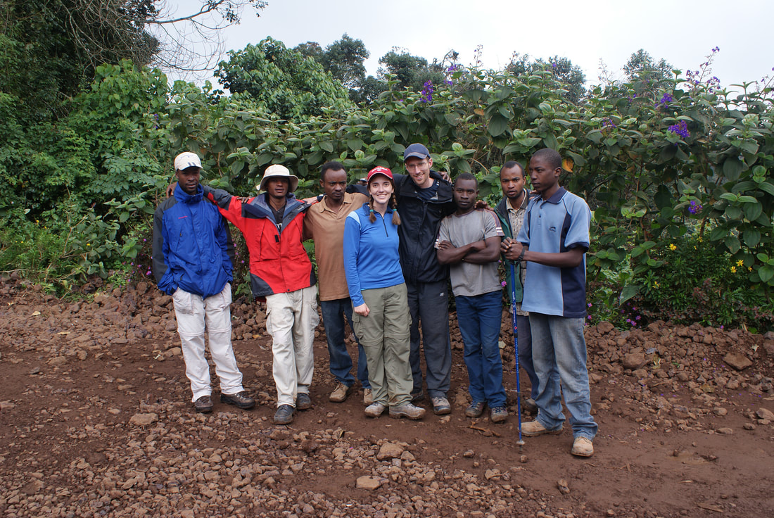
Thank you to our incredible team, who made our climb that much more enjoyable
Asante sana Kili for an incredible adventure. There were highs and lows (physical and metaphorical!) but we did love climbing you. Hopefully we will be back again.
After Kilimanjaro, we went on Safari to tour Lake Tarangire, the Serengeti and Ngorongoro Crater and then onto the beaches of Zanzibar to relax in the sun. Once we returned home, we began an adventure of a different kind, one that came with ten little fingers and ten little toes...
Comment Box is loading comments...
Click on the links below to see photos of the other parts of this trip:
